You are here: Home > Network List > TA - USArray Transportable Network (new EarthScope stations) Stations List
> Station D46A Sault St. Marie, ON, CAN > Earthquake Result Viewer
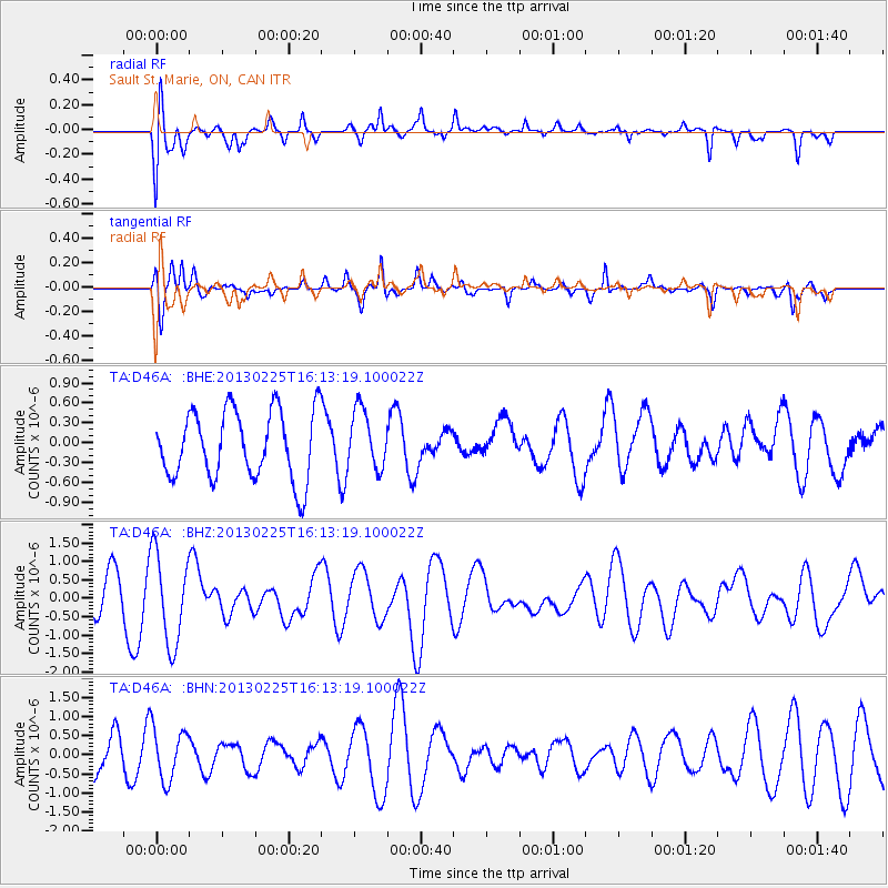
D46A Sault St. Marie, ON, CAN - Earthquake Result Viewer
*The percent match for this event was below the threshold and hence no stack was calculated.
| Earthquake location: |
Southeast Of Ryukyu Islands |
| Earthquake latitude/longitude: |
29.0/131.5 |
| Earthquake time(UTC): |
2013/02/25 (056) 16:00:19 GMT |
| Earthquake Depth: |
46 km |
| Earthquake Magnitude: |
5.5 MB, 5.4 MW |
| Earthquake Catalog/Contributor: |
WHDF/NEIC |
|
| Network: |
TA USArray Transportable Network (new EarthScope stations) |
| Station: |
D46A Sault St. Marie, ON, CAN |
| Lat/Lon: |
46.89 N/84.04 W |
| Elevation: |
353 m |
|
| Distance: |
97.9 deg |
| Az: |
23.734 deg |
| Baz: |
329.067 deg |
| Ray Param: |
$rayparam |
*The percent match for this event was below the threshold and hence was not used in the summary stack. |
|
| Radial Match: |
66.015686 % |
| Radial Bump: |
400 |
| Transverse Match: |
71.985146 % |
| Transverse Bump: |
349 |
| SOD ConfigId: |
494114 |
| Insert Time: |
2013-05-09 06:13:19.314 +0000 |
| GWidth: |
2.5 |
| Max Bumps: |
400 |
| Tol: |
0.001 |
|
Signal To Noise
| Channel | StoN | STA | LTA |
| TA:D46A: :BHZ:20130225T16:13:19.100022Z | 1.8749204 | 1.2203656E-6 | 6.5088926E-7 |
| TA:D46A: :BHN:20130225T16:13:19.100022Z | 1.8282185 | 6.7686585E-7 | 3.7023247E-7 |
| TA:D46A: :BHE:20130225T16:13:19.100022Z | 0.8671423 | 4.4694303E-7 | 5.1542065E-7 |
| Arrivals |
| Ps | |
| PpPs | |
| PsPs/PpSs | |


