You are here: Home > Network List > CI - Caltech Regional Seismic Network Stations List
> Station BAR Barrett, Tecate, CA, USA > Earthquake Result Viewer
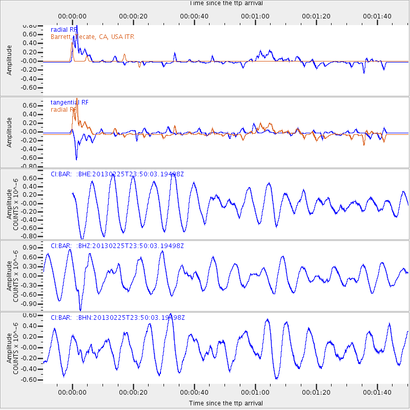
BAR Barrett, Tecate, CA, USA - Earthquake Result Viewer
*The percent match for this event was below the threshold and hence no stack was calculated.
| Earthquake location: |
Southern Pacific Ocean |
| Earthquake latitude/longitude: |
-48.4/-87.1 |
| Earthquake time(UTC): |
2013/02/25 (056) 23:37:59 GMT |
| Earthquake Depth: |
10 km |
| Earthquake Magnitude: |
5.5 MB, 4.8 MS, 5.2 MW |
| Earthquake Catalog/Contributor: |
WHDF/NEIC |
|
| Network: |
CI Caltech Regional Seismic Network |
| Station: |
BAR Barrett, Tecate, CA, USA |
| Lat/Lon: |
32.68 N/116.67 W |
| Elevation: |
521 m |
|
| Distance: |
84.9 deg |
| Az: |
335.32 deg |
| Baz: |
160.728 deg |
| Ray Param: |
$rayparam |
*The percent match for this event was below the threshold and hence was not used in the summary stack. |
|
| Radial Match: |
83.146255 % |
| Radial Bump: |
391 |
| Transverse Match: |
77.63442 % |
| Transverse Bump: |
400 |
| SOD ConfigId: |
494114 |
| Insert Time: |
2013-05-09 06:15:45.151 +0000 |
| GWidth: |
2.5 |
| Max Bumps: |
400 |
| Tol: |
0.001 |
|
Signal To Noise
| Channel | StoN | STA | LTA |
| CI:BAR: :BHZ:20130225T23:50:03.19498Z | 1.0417747 | 6.0402414E-7 | 5.79803E-7 |
| CI:BAR: :BHN:20130225T23:50:03.19498Z | 0.6264044 | 2.434269E-7 | 3.8860983E-7 |
| CI:BAR: :BHE:20130225T23:50:03.19498Z | 1.1428158 | 5.2919717E-7 | 4.6306428E-7 |
| Arrivals |
| Ps | |
| PpPs | |
| PsPs/PpSs | |


