
DBIC Dimbokro, Cote d'Ivoire - Earthquake Result Viewer
| ||||||||||||||||||
| ||||||||||||||||||
| ||||||||||||||||||
|
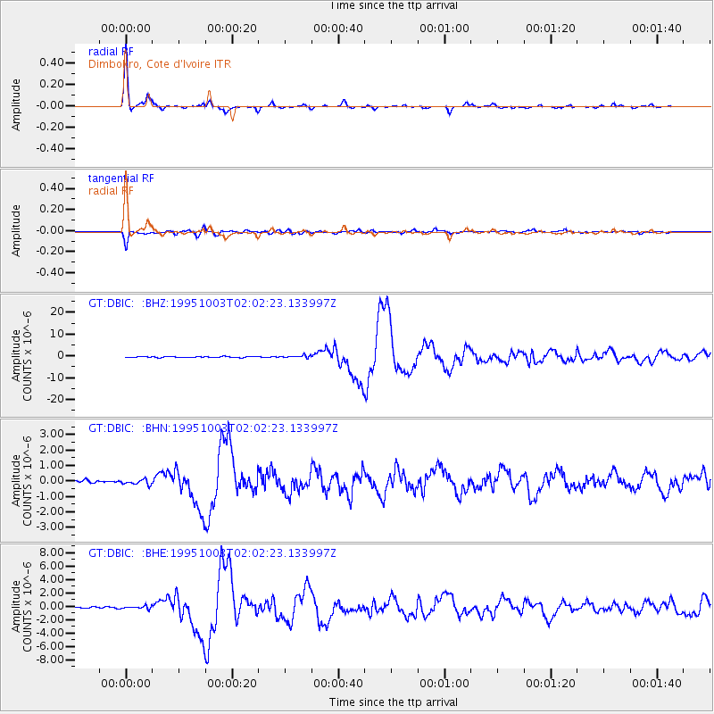
Signal To Noise
| Channel | StoN | STA | LTA |
| GT:DBIC: :BHN:19951003T02:02:23.133997Z | 1.0397681 | 1.6274926E-7 | 1.5652458E-7 |
| GT:DBIC: :BHE:19951003T02:02:23.133997Z | 2.3499157 | 2.214444E-7 | 9.4235034E-8 |
| GT:DBIC: :BHZ:19951003T02:02:23.133997Z | 2.5686772 | 5.74355E-7 | 2.2359951E-7 |
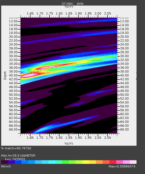
| Arrivals | |
| Ps | 4.3 SECOND |
| PpPs | 15 SECOND |
| PsPs/PpSs | 19 SECOND |

