You are here: Home > Network List > NE - New England Seismic Network Stations List
> Station PQI Presque Isle, ME, USA > Earthquake Result Viewer
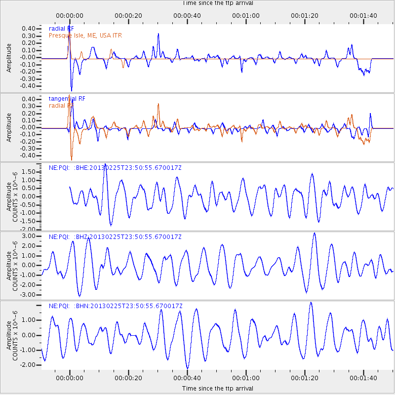
PQI Presque Isle, ME, USA - Earthquake Result Viewer
*The percent match for this event was below the threshold and hence no stack was calculated.
| Earthquake location: |
Southern Pacific Ocean |
| Earthquake latitude/longitude: |
-48.4/-87.1 |
| Earthquake time(UTC): |
2013/02/25 (056) 23:37:59 GMT |
| Earthquake Depth: |
10 km |
| Earthquake Magnitude: |
5.5 MB, 4.8 MS, 5.2 MW |
| Earthquake Catalog/Contributor: |
WHDF/NEIC |
|
| Network: |
NE New England Seismic Network |
| Station: |
PQI Presque Isle, ME, USA |
| Lat/Lon: |
46.67 N/68.02 W |
| Elevation: |
162 m |
|
| Distance: |
96.1 deg |
| Az: |
13.101 deg |
| Baz: |
192.676 deg |
| Ray Param: |
$rayparam |
*The percent match for this event was below the threshold and hence was not used in the summary stack. |
|
| Radial Match: |
69.354004 % |
| Radial Bump: |
400 |
| Transverse Match: |
65.99692 % |
| Transverse Bump: |
400 |
| SOD ConfigId: |
494114 |
| Insert Time: |
2013-05-09 06:17:16.352 +0000 |
| GWidth: |
2.5 |
| Max Bumps: |
400 |
| Tol: |
0.001 |
|
Signal To Noise
| Channel | StoN | STA | LTA |
| NE:PQI: :BHZ:20130225T23:50:55.670017Z | 1.6931782 | 1.9231813E-6 | 1.1358411E-6 |
| NE:PQI: :BHN:20130225T23:50:55.670017Z | 0.774155 | 7.5831133E-7 | 9.795342E-7 |
| NE:PQI: :BHE:20130225T23:50:55.670017Z | 0.8757887 | 6.368273E-7 | 7.2714715E-7 |
| Arrivals |
| Ps | |
| PpPs | |
| PsPs/PpSs | |


