You are here: Home > Network List > TA - USArray Transportable Network (new EarthScope stations) Stations List
> Station W47A Westpoint, TN, USA > Earthquake Result Viewer
W47A Westpoint, TN, USA - Earthquake Result Viewer
*The percent match for this event was below the threshold and hence no stack was calculated.
| Earthquake location: |
Southern Pacific Ocean |
| Earthquake latitude/longitude: |
-48.4/-87.1 |
| Earthquake time(UTC): |
2013/02/25 (056) 23:37:59 GMT |
| Earthquake Depth: |
10 km |
| Earthquake Magnitude: |
5.5 MB, 4.8 MS, 5.2 MW |
| Earthquake Catalog/Contributor: |
WHDF/NEIC |
|
| Network: |
TA USArray Transportable Network (new EarthScope stations) |
| Station: |
W47A Westpoint, TN, USA |
| Lat/Lon: |
35.25 N/87.59 W |
| Elevation: |
293 m |
|
| Distance: |
83.3 deg |
| Az: |
359.611 deg |
| Baz: |
179.683 deg |
| Ray Param: |
$rayparam |
*The percent match for this event was below the threshold and hence was not used in the summary stack. |
|
| Radial Match: |
51.542965 % |
| Radial Bump: |
400 |
| Transverse Match: |
55.586407 % |
| Transverse Bump: |
400 |
| SOD ConfigId: |
494114 |
| Insert Time: |
2013-05-09 06:20:08.957 +0000 |
| GWidth: |
2.5 |
| Max Bumps: |
400 |
| Tol: |
0.001 |
|
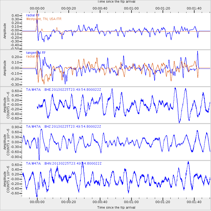
Signal To Noise
| Channel | StoN | STA | LTA |
| TA:W47A: :BHZ:20130225T23:49:54.800022Z | 2.5303822 | 4.9743426E-7 | 1.9658465E-7 |
| TA:W47A: :BHN:20130225T23:49:54.800022Z | 1.362606 | 3.1629688E-7 | 2.3212644E-7 |
| TA:W47A: :BHE:20130225T23:49:54.800022Z | 1.1585424 | 2.4765495E-7 | 2.1376424E-7 |
| Arrivals |
| Ps | |
| PpPs | |
| PsPs/PpSs | |


