You are here: Home > Network List > TA - USArray Transportable Network (new EarthScope stations) Stations List
> Station G59A Clarenceville, QC, USA > Earthquake Result Viewer
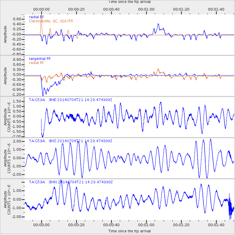
G59A Clarenceville, QC, USA - Earthquake Result Viewer
*The percent match for this event was below the threshold and hence no stack was calculated.
| Earthquake location: |
Azores Islands Region |
| Earthquake latitude/longitude: |
35.1/-34.9 |
| Earthquake time(UTC): |
2014/07/04 (185) 21:08:45 GMT |
| Earthquake Depth: |
10 km |
| Earthquake Magnitude: |
5.6 MW, 5.2 mb, 5.0 Ms_20, 5.4 Mwb, 5.6 Mwc |
| Earthquake Catalog/Contributor: |
ISC/ISC |
|
| Network: |
TA USArray Transportable Network (new EarthScope stations) |
| Station: |
G59A Clarenceville, QC, USA |
| Lat/Lon: |
45.08 N/73.18 W |
| Elevation: |
36 m |
|
| Distance: |
30.7 deg |
| Az: |
300.704 deg |
| Baz: |
95.516 deg |
| Ray Param: |
$rayparam |
*The percent match for this event was below the threshold and hence was not used in the summary stack. |
|
| Radial Match: |
34.18917 % |
| Radial Bump: |
400 |
| Transverse Match: |
39.018158 % |
| Transverse Bump: |
400 |
| SOD ConfigId: |
3390531 |
| Insert Time: |
2019-04-12 16:54:57.730 +0000 |
| GWidth: |
2.5 |
| Max Bumps: |
400 |
| Tol: |
0.001 |
|
Signal To Noise
| Channel | StoN | STA | LTA |
| TA:G59A: :BHZ:20140704T21:14:29.474999Z | 0.5411536 | 5.133124E-7 | 9.485521E-7 |
| TA:G59A: :BHN:20140704T21:14:29.474999Z | 0.6745252 | 8.8984154E-7 | 1.3192118E-6 |
| TA:G59A: :BHE:20140704T21:14:29.474999Z | 0.94023615 | 5.064666E-7 | 5.386589E-7 |
| Arrivals |
| Ps | |
| PpPs | |
| PsPs/PpSs | |


