You are here: Home > Network List > CI - Caltech Regional Seismic Network Stations List
> Station MPM Manuel Prospect Mine, California, USA > Earthquake Result Viewer
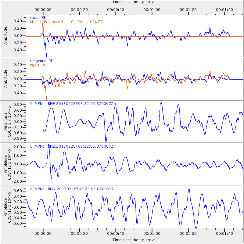
MPM Manuel Prospect Mine, California, USA - Earthquake Result Viewer
*The percent match for this event was below the threshold and hence no stack was calculated.
| Earthquake location: |
Vanuatu Islands |
| Earthquake latitude/longitude: |
-17.7/167.3 |
| Earthquake time(UTC): |
2013/02/28 (059) 03:09:44 GMT |
| Earthquake Depth: |
18 km |
| Earthquake Magnitude: |
6.0 MB, 5.7 MS, 5.9 MW, 5.7 MW |
| Earthquake Catalog/Contributor: |
WHDF/NEIC |
|
| Network: |
CI Caltech Regional Seismic Network |
| Station: |
MPM Manuel Prospect Mine, California, USA |
| Lat/Lon: |
36.06 N/117.49 W |
| Elevation: |
185 m |
|
| Distance: |
88.8 deg |
| Az: |
51.58 deg |
| Baz: |
247.16 deg |
| Ray Param: |
$rayparam |
*The percent match for this event was below the threshold and hence was not used in the summary stack. |
|
| Radial Match: |
79.831276 % |
| Radial Bump: |
400 |
| Transverse Match: |
75.75299 % |
| Transverse Bump: |
400 |
| SOD ConfigId: |
494114 |
| Insert Time: |
2013-05-15 04:36:07.045 +0000 |
| GWidth: |
2.5 |
| Max Bumps: |
400 |
| Tol: |
0.001 |
|
Signal To Noise
| Channel | StoN | STA | LTA |
| CI:MPM: :BHZ:20130228T03:22:05.870007Z | 2.8770638 | 1.0556573E-6 | 3.6692177E-7 |
| CI:MPM: :BHN:20130228T03:22:05.870007Z | 1.2105347 | 2.3474328E-7 | 1.9391702E-7 |
| CI:MPM: :BHE:20130228T03:22:05.870007Z | 1.1756868 | 4.34116E-7 | 3.692446E-7 |
| Arrivals |
| Ps | |
| PpPs | |
| PsPs/PpSs | |


