
DBIC Dimbokro, Cote d'Ivoire - Earthquake Result Viewer
| ||||||||||||||||||
| ||||||||||||||||||
| ||||||||||||||||||
|
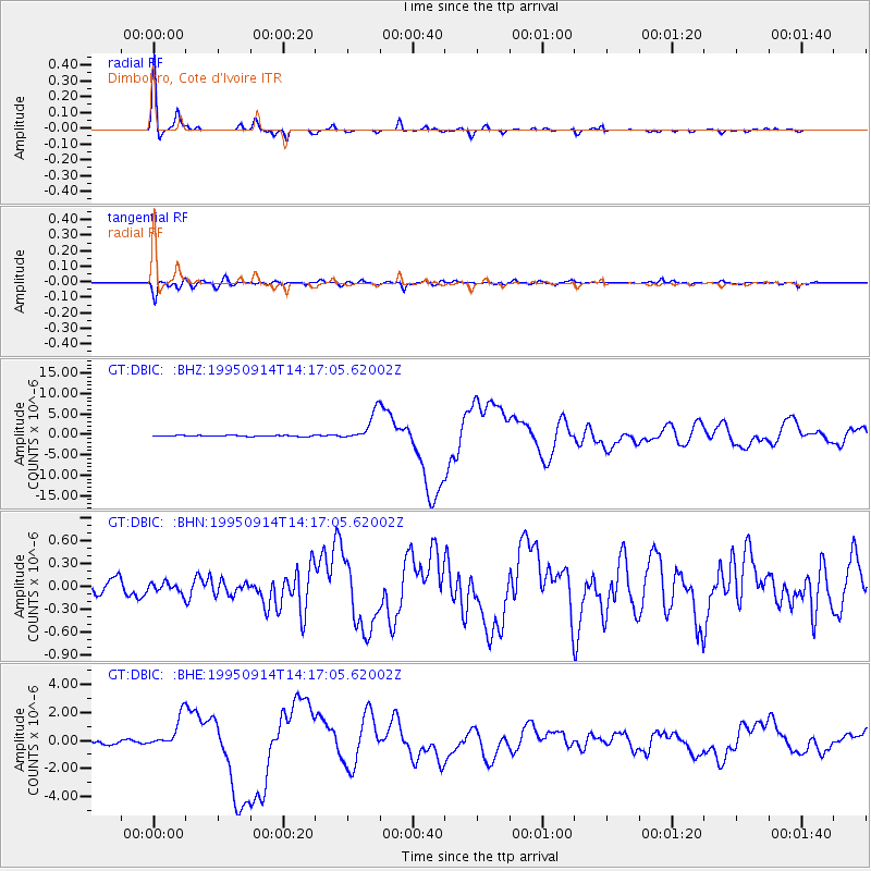
Signal To Noise
| Channel | StoN | STA | LTA |
| GT:DBIC: :BHN:19950914T14:17:05.62002Z | 0.6632981 | 6.710325E-8 | 1.01166066E-7 |
| GT:DBIC: :BHE:19950914T14:17:05.62002Z | 9.73798 | 1.1497757E-6 | 1.1807127E-7 |
| GT:DBIC: :BHZ:19950914T14:17:05.62002Z | 25.355816 | 3.477018E-6 | 1.3712902E-7 |
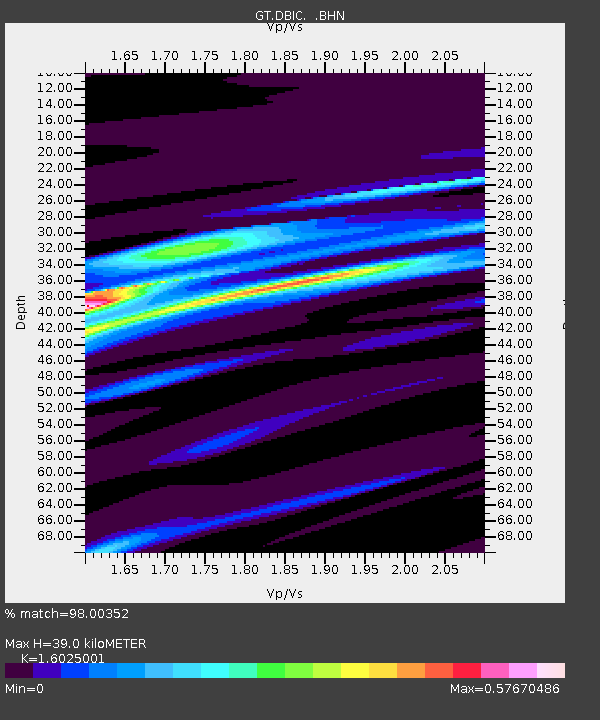
| Arrivals | |
| Ps | 3.7 SECOND |
| PpPs | 15 SECOND |
| PsPs/PpSs | 19 SECOND |

