You are here: Home > Network List > TA - USArray Transportable Network (new EarthScope stations) Stations List
> Station N02D Trinity Center, CA, USA > Earthquake Result Viewer
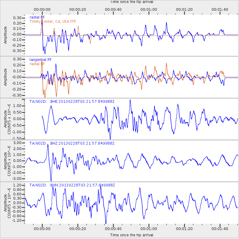
N02D Trinity Center, CA, USA - Earthquake Result Viewer
*The percent match for this event was below the threshold and hence no stack was calculated.
| Earthquake location: |
Vanuatu Islands |
| Earthquake latitude/longitude: |
-17.7/167.3 |
| Earthquake time(UTC): |
2013/02/28 (059) 03:09:44 GMT |
| Earthquake Depth: |
18 km |
| Earthquake Magnitude: |
6.0 MB, 5.7 MS, 5.9 MW, 5.7 MW |
| Earthquake Catalog/Contributor: |
WHDF/NEIC |
|
| Network: |
TA USArray Transportable Network (new EarthScope stations) |
| Station: |
N02D Trinity Center, CA, USA |
| Lat/Lon: |
40.97 N/122.71 W |
| Elevation: |
937 m |
|
| Distance: |
87.1 deg |
| Az: |
45.415 deg |
| Baz: |
243.705 deg |
| Ray Param: |
$rayparam |
*The percent match for this event was below the threshold and hence was not used in the summary stack. |
|
| Radial Match: |
64.03117 % |
| Radial Bump: |
400 |
| Transverse Match: |
47.490997 % |
| Transverse Bump: |
400 |
| SOD ConfigId: |
494114 |
| Insert Time: |
2013-05-15 04:40:17.882 +0000 |
| GWidth: |
2.5 |
| Max Bumps: |
400 |
| Tol: |
0.001 |
|
Signal To Noise
| Channel | StoN | STA | LTA |
| TA:N02D: :BHZ:20130228T03:21:57.849988Z | 3.6202848 | 1.1830913E-6 | 3.267951E-7 |
| TA:N02D: :BHN:20130228T03:21:57.849988Z | 1.9081157 | 5.588666E-7 | 2.9288927E-7 |
| TA:N02D: :BHE:20130228T03:21:57.849988Z | 0.61551636 | 2.2199495E-7 | 3.606646E-7 |
| Arrivals |
| Ps | |
| PpPs | |
| PsPs/PpSs | |


