You are here: Home > Network List > UW - Pacific Northwest Regional Seismic Network Stations List
> Station UMAT Pilot Rock, OR, USA > Earthquake Result Viewer
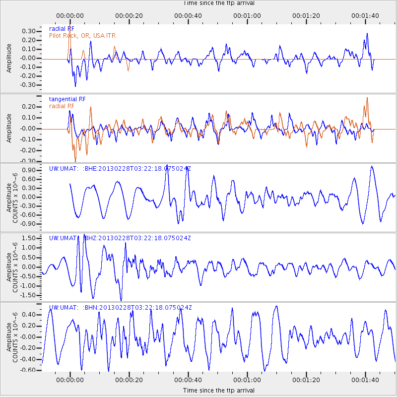
UMAT Pilot Rock, OR, USA - Earthquake Result Viewer
*The percent match for this event was below the threshold and hence no stack was calculated.
| Earthquake location: |
Vanuatu Islands |
| Earthquake latitude/longitude: |
-17.7/167.3 |
| Earthquake time(UTC): |
2013/02/28 (059) 03:09:44 GMT |
| Earthquake Depth: |
18 km |
| Earthquake Magnitude: |
6.0 MB, 5.7 MS, 5.9 MW, 5.7 MW |
| Earthquake Catalog/Contributor: |
WHDF/NEIC |
|
| Network: |
UW Pacific Northwest Regional Seismic Network |
| Station: |
UMAT Pilot Rock, OR, USA |
| Lat/Lon: |
45.29 N/118.96 W |
| Elevation: |
1318 m |
|
| Distance: |
91.5 deg |
| Az: |
42.668 deg |
| Baz: |
246.225 deg |
| Ray Param: |
$rayparam |
*The percent match for this event was below the threshold and hence was not used in the summary stack. |
|
| Radial Match: |
65.293625 % |
| Radial Bump: |
400 |
| Transverse Match: |
80.26132 % |
| Transverse Bump: |
358 |
| SOD ConfigId: |
494114 |
| Insert Time: |
2013-05-15 04:41:47.555 +0000 |
| GWidth: |
2.5 |
| Max Bumps: |
400 |
| Tol: |
0.001 |
|
Signal To Noise
| Channel | StoN | STA | LTA |
| UW:UMAT: :BHZ:20130228T03:22:18.075024Z | 1.7126826 | 9.29392E-7 | 5.426528E-7 |
| UW:UMAT: :BHN:20130228T03:22:18.075024Z | 0.8084948 | 2.7978334E-7 | 3.460546E-7 |
| UW:UMAT: :BHE:20130228T03:22:18.075024Z | 1.1788694 | 4.6425046E-7 | 3.938099E-7 |
| Arrivals |
| Ps | |
| PpPs | |
| PsPs/PpSs | |


