You are here: Home > Network List > CI - Caltech Regional Seismic Network Stations List
> Station BAR Barrett, Tecate, CA, USA > Earthquake Result Viewer
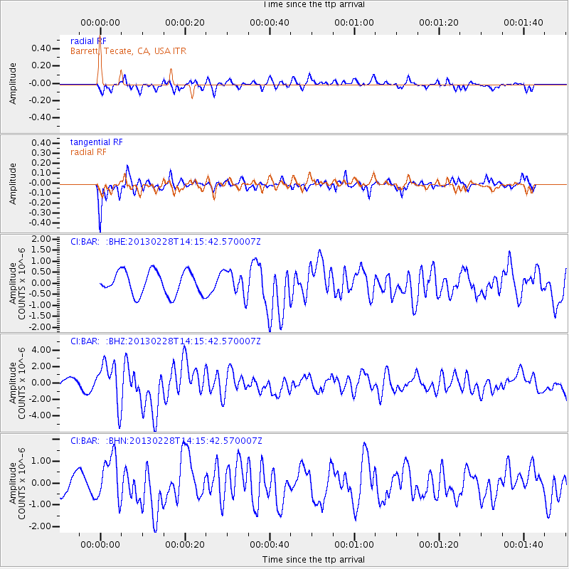
BAR Barrett, Tecate, CA, USA - Earthquake Result Viewer
*The percent match for this event was below the threshold and hence no stack was calculated.
| Earthquake location: |
Kuril Islands |
| Earthquake latitude/longitude: |
51.0/157.3 |
| Earthquake time(UTC): |
2013/02/28 (059) 14:05:50 GMT |
| Earthquake Depth: |
41 km |
| Earthquake Magnitude: |
6.4 MB, 6.7 MS, 6.9 MW, 6.8 MW |
| Earthquake Catalog/Contributor: |
WHDF/NEIC |
|
| Network: |
CI Caltech Regional Seismic Network |
| Station: |
BAR Barrett, Tecate, CA, USA |
| Lat/Lon: |
32.68 N/116.67 W |
| Elevation: |
521 m |
|
| Distance: |
63.1 deg |
| Az: |
70.688 deg |
| Baz: |
314.945 deg |
| Ray Param: |
$rayparam |
*The percent match for this event was below the threshold and hence was not used in the summary stack. |
|
| Radial Match: |
79.64047 % |
| Radial Bump: |
400 |
| Transverse Match: |
87.326614 % |
| Transverse Bump: |
311 |
| SOD ConfigId: |
494114 |
| Insert Time: |
2013-05-15 04:49:03.376 +0000 |
| GWidth: |
2.5 |
| Max Bumps: |
400 |
| Tol: |
0.001 |
|
Signal To Noise
| Channel | StoN | STA | LTA |
| CI:BAR: :BHZ:20130228T14:15:42.570007Z | 3.7609892 | 2.5536278E-6 | 6.789777E-7 |
| CI:BAR: :BHN:20130228T14:15:42.570007Z | 2.6007159 | 1.087155E-6 | 4.1802144E-7 |
| CI:BAR: :BHE:20130228T14:15:42.570007Z | 1.076264 | 5.5928956E-7 | 5.1965833E-7 |
| Arrivals |
| Ps | |
| PpPs | |
| PsPs/PpSs | |


