
DBIC Dimbokro, Cote d'Ivoire - Earthquake Result Viewer
| ||||||||||||||||||
| ||||||||||||||||||
| ||||||||||||||||||
|
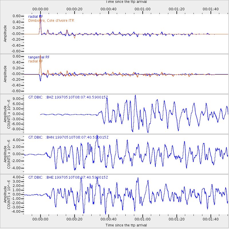
Signal To Noise
| Channel | StoN | STA | LTA |
| GT:DBIC: :BHN:19970510T08:07:40.590015Z | 2.8048322 | 2.3839358E-7 | 8.4993886E-8 |
| GT:DBIC: :BHE:19970510T08:07:40.590015Z | 2.3969276 | 1.7679457E-7 | 7.375883E-8 |
| GT:DBIC: :BHZ:19970510T08:07:40.590015Z | 2.7980804 | 4.5923312E-7 | 1.6412434E-7 |
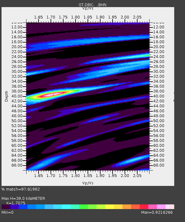
| Arrivals | |
| Ps | 4.5 SECOND |
| PpPs | 16 SECOND |
| PsPs/PpSs | 20 SECOND |

