
DBIC Dimbokro, Cote d'Ivoire - Earthquake Result Viewer
| ||||||||||||||||||
| ||||||||||||||||||
| ||||||||||||||||||
|
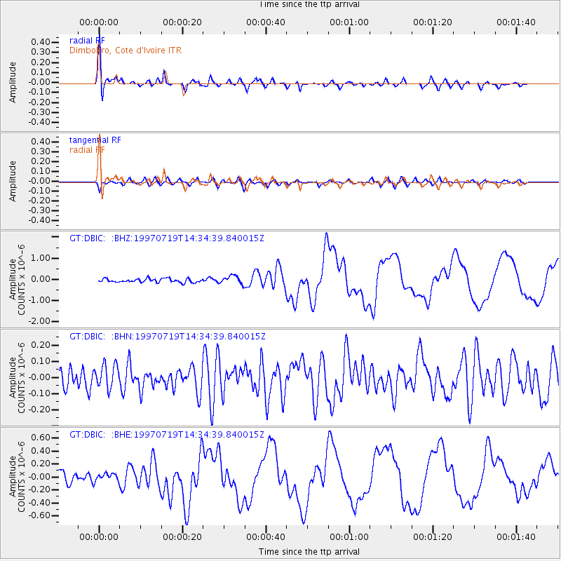
Signal To Noise
| Channel | StoN | STA | LTA |
| GT:DBIC: :BHN:19970719T14:34:39.840015Z | 0.990553 | 7.513932E-8 | 7.585593E-8 |
| GT:DBIC: :BHE:19970719T14:34:39.840015Z | 0.57969147 | 4.917651E-8 | 8.4832216E-8 |
| GT:DBIC: :BHZ:19970719T14:34:39.840015Z | 2.2796586 | 1.9644078E-7 | 8.617114E-8 |
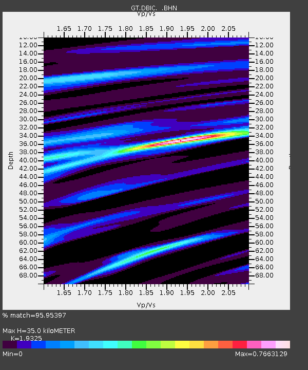
| Arrivals | |
| Ps | 5.2 SECOND |
| PpPs | 16 SECOND |
| PsPs/PpSs | 21 SECOND |

