You are here: Home > Network List > TA - USArray Transportable Network (new EarthScope stations) Stations List
> Station T25A Trinidad, CO, USA > Earthquake Result Viewer
T25A Trinidad, CO, USA - Earthquake Result Viewer

| Earthquake location: |
Kuril Islands |
| Earthquake latitude/longitude: |
51.0/157.3 |
| Earthquake time(UTC): |
2013/02/28 (059) 14:05:50 GMT |
| Earthquake Depth: |
41 km |
| Earthquake Magnitude: |
6.4 MB, 6.7 MS, 6.9 MW, 6.8 MW |
| Earthquake Catalog/Contributor: |
WHDF/NEIC |
|
| Network: |
TA USArray Transportable Network (new EarthScope stations) |
| Station: |
T25A Trinidad, CO, USA |
| Lat/Lon: |
37.14 N/104.41 W |
| Elevation: |
2017 m |
|
| Distance: |
66.9 deg |
| Az: |
59.292 deg |
| Baz: |
317.117 deg |
| Ray Param: |
0.057244733 |
| Estimated Moho Depth: |
42.0 km |
| Estimated Crust Vp/Vs: |
1.75 |
| Assumed Crust Vp: |
6.316 km/s |
| Estimated Crust Vs: |
3.599 km/s |
| Estimated Crust Poisson's Ratio: |
0.26 |
|
| Radial Match: |
94.19751 % |
| Radial Bump: |
400 |
| Transverse Match: |
82.14707 % |
| Transverse Bump: |
400 |
| SOD ConfigId: |
494114 |
| Insert Time: |
2013-05-15 05:05:44.953 +0000 |
| GWidth: |
2.5 |
| Max Bumps: |
400 |
| Tol: |
0.001 |
|
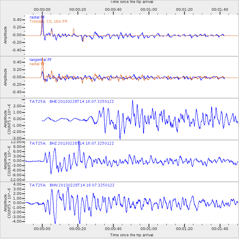
Signal To Noise
| Channel | StoN | STA | LTA |
| TA:T25A: :BHZ:20130228T14:16:07.325012Z | 14.37168 | 2.8459756E-6 | 1.9802665E-7 |
| TA:T25A: :BHN:20130228T14:16:07.325012Z | 5.907279 | 9.686598E-7 | 1.6397733E-7 |
| TA:T25A: :BHE:20130228T14:16:07.325012Z | 5.8252773 | 9.187535E-7 | 1.5771842E-7 |
| Arrivals |
| Ps | 5.2 SECOND |
| PpPs | 18 SECOND |
| PsPs/PpSs | 23 SECOND |


