You are here: Home > Network List > TA - USArray Transportable Network (new EarthScope stations) Stations List
> Station K40A Colesburg, IA, USA > Earthquake Result Viewer
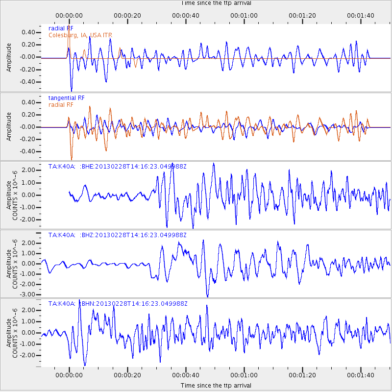
K40A Colesburg, IA, USA - Earthquake Result Viewer
*The percent match for this event was below the threshold and hence no stack was calculated.
| Earthquake location: |
Kuril Islands |
| Earthquake latitude/longitude: |
51.0/157.3 |
| Earthquake time(UTC): |
2013/02/28 (059) 14:05:50 GMT |
| Earthquake Depth: |
41 km |
| Earthquake Magnitude: |
6.4 MB, 6.7 MS, 6.9 MW, 6.8 MW |
| Earthquake Catalog/Contributor: |
WHDF/NEIC |
|
| Network: |
TA USArray Transportable Network (new EarthScope stations) |
| Station: |
K40A Colesburg, IA, USA |
| Lat/Lon: |
42.70 N/91.14 W |
| Elevation: |
274 m |
|
| Distance: |
69.4 deg |
| Az: |
47.084 deg |
| Baz: |
321.071 deg |
| Ray Param: |
$rayparam |
*The percent match for this event was below the threshold and hence was not used in the summary stack. |
|
| Radial Match: |
33.38306 % |
| Radial Bump: |
400 |
| Transverse Match: |
44.838257 % |
| Transverse Bump: |
400 |
| SOD ConfigId: |
494114 |
| Insert Time: |
2013-05-15 05:11:31.171 +0000 |
| GWidth: |
2.5 |
| Max Bumps: |
400 |
| Tol: |
0.001 |
|
Signal To Noise
| Channel | StoN | STA | LTA |
| TA:K40A: :BHZ:20130228T14:16:23.049988Z | 0.69926316 | 2.0110105E-7 | 2.8758993E-7 |
| TA:K40A: :BHN:20130228T14:16:23.049988Z | 4.5758963 | 1.3800237E-6 | 3.0158546E-7 |
| TA:K40A: :BHE:20130228T14:16:23.049988Z | 4.59196 | 1.2235612E-6 | 2.6645728E-7 |
| Arrivals |
| Ps | |
| PpPs | |
| PsPs/PpSs | |


