You are here: Home > Network List > TA - USArray Transportable Network (new EarthScope stations) Stations List
> Station X48A Hartselle, AL, USA > Earthquake Result Viewer
X48A Hartselle, AL, USA - Earthquake Result Viewer

| Earthquake location: |
Kuril Islands |
| Earthquake latitude/longitude: |
51.0/157.3 |
| Earthquake time(UTC): |
2013/02/28 (059) 14:05:50 GMT |
| Earthquake Depth: |
41 km |
| Earthquake Magnitude: |
6.4 MB, 6.7 MS, 6.9 MW, 6.8 MW |
| Earthquake Catalog/Contributor: |
WHDF/NEIC |
|
| Network: |
TA USArray Transportable Network (new EarthScope stations) |
| Station: |
X48A Hartselle, AL, USA |
| Lat/Lon: |
34.45 N/87.05 W |
| Elevation: |
180 m |
|
| Distance: |
77.9 deg |
| Az: |
49.618 deg |
| Baz: |
324.336 deg |
| Ray Param: |
0.04994636 |
| Estimated Moho Depth: |
46.0 km |
| Estimated Crust Vp/Vs: |
1.73 |
| Assumed Crust Vp: |
6.476 km/s |
| Estimated Crust Vs: |
3.738 km/s |
| Estimated Crust Poisson's Ratio: |
0.25 |
|
| Radial Match: |
90.95815 % |
| Radial Bump: |
368 |
| Transverse Match: |
80.63199 % |
| Transverse Bump: |
400 |
| SOD ConfigId: |
494114 |
| Insert Time: |
2013-05-15 05:20:52.306 +0000 |
| GWidth: |
2.5 |
| Max Bumps: |
400 |
| Tol: |
0.001 |
|
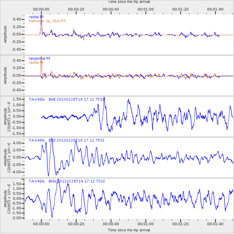
Signal To Noise
| Channel | StoN | STA | LTA |
| TA:X48A: :BHZ:20130228T14:17:12.750Z | 13.641511 | 2.7481808E-6 | 2.0145721E-7 |
| TA:X48A: :BHN:20130228T14:17:12.750Z | 3.7692645 | 7.791036E-7 | 2.066991E-7 |
| TA:X48A: :BHE:20130228T14:17:12.750Z | 6.6926312 | 6.243166E-7 | 9.328417E-8 |
| Arrivals |
| Ps | 5.4 SECOND |
| PpPs | 19 SECOND |
| PsPs/PpSs | 24 SECOND |


