You are here: Home > Network List > TA - USArray Transportable Network (new EarthScope stations) Stations List
> Station 452A Marianna, FL, USA > Earthquake Result Viewer
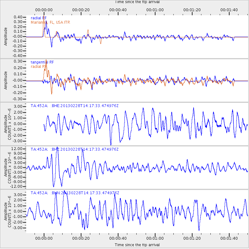
452A Marianna, FL, USA - Earthquake Result Viewer
*The percent match for this event was below the threshold and hence no stack was calculated.
| Earthquake location: |
Kuril Islands |
| Earthquake latitude/longitude: |
51.0/157.3 |
| Earthquake time(UTC): |
2013/02/28 (059) 14:05:50 GMT |
| Earthquake Depth: |
41 km |
| Earthquake Magnitude: |
6.4 MB, 6.7 MS, 6.9 MW, 6.8 MW |
| Earthquake Catalog/Contributor: |
WHDF/NEIC |
|
| Network: |
TA USArray Transportable Network (new EarthScope stations) |
| Station: |
452A Marianna, FL, USA |
| Lat/Lon: |
30.85 N/85.18 W |
| Elevation: |
35 m |
|
| Distance: |
81.7 deg |
| Az: |
50.41 deg |
| Baz: |
325.477 deg |
| Ray Param: |
$rayparam |
*The percent match for this event was below the threshold and hence was not used in the summary stack. |
|
| Radial Match: |
82.912254 % |
| Radial Bump: |
400 |
| Transverse Match: |
73.7841 % |
| Transverse Bump: |
400 |
| SOD ConfigId: |
494114 |
| Insert Time: |
2013-05-15 05:22:37.221 +0000 |
| GWidth: |
2.5 |
| Max Bumps: |
400 |
| Tol: |
0.001 |
|
Signal To Noise
| Channel | StoN | STA | LTA |
| TA:452A: :BHZ:20130228T14:17:33.474976Z | 6.177888 | 3.777948E-6 | 6.1152747E-7 |
| TA:452A: :BHN:20130228T14:17:33.474976Z | 1.2582754 | 9.182383E-7 | 7.297594E-7 |
| TA:452A: :BHE:20130228T14:17:33.474976Z | 1.0801195 | 9.3803556E-7 | 8.6845534E-7 |
| Arrivals |
| Ps | |
| PpPs | |
| PsPs/PpSs | |


