You are here: Home > Network List > TA - USArray Transportable Network (new EarthScope stations) Stations List
> Station Y51A Rockmart, GA, USA > Earthquake Result Viewer
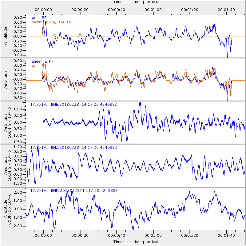
Y51A Rockmart, GA, USA - Earthquake Result Viewer
*The percent match for this event was below the threshold and hence no stack was calculated.
| Earthquake location: |
Kuril Islands |
| Earthquake latitude/longitude: |
51.0/157.3 |
| Earthquake time(UTC): |
2013/02/28 (059) 14:05:50 GMT |
| Earthquake Depth: |
41 km |
| Earthquake Magnitude: |
6.4 MB, 6.7 MS, 6.9 MW, 6.8 MW |
| Earthquake Catalog/Contributor: |
WHDF/NEIC |
|
| Network: |
TA USArray Transportable Network (new EarthScope stations) |
| Station: |
Y51A Rockmart, GA, USA |
| Lat/Lon: |
33.90 N/85.06 W |
| Elevation: |
380 m |
|
| Distance: |
79.3 deg |
| Az: |
48.573 deg |
| Baz: |
325.237 deg |
| Ray Param: |
$rayparam |
*The percent match for this event was below the threshold and hence was not used in the summary stack. |
|
| Radial Match: |
43.476727 % |
| Radial Bump: |
400 |
| Transverse Match: |
49.742905 % |
| Transverse Bump: |
400 |
| SOD ConfigId: |
494114 |
| Insert Time: |
2013-05-15 05:25:42.414 +0000 |
| GWidth: |
2.5 |
| Max Bumps: |
400 |
| Tol: |
0.001 |
|
Signal To Noise
| Channel | StoN | STA | LTA |
| TA:Y51A: :BHZ:20130228T14:17:20.424988Z | 0.62659276 | 2.644194E-7 | 4.2199562E-7 |
| TA:Y51A: :BHN:20130228T14:17:20.424988Z | 0.58904475 | 9.571509E-7 | 1.6249205E-6 |
| TA:Y51A: :BHE:20130228T14:17:20.424988Z | 4.878448 | 6.107416E-7 | 1.2519178E-7 |
| Arrivals |
| Ps | |
| PpPs | |
| PsPs/PpSs | |


