LON Longmire (broad-band and DWWSSN) - Earthquake Result Viewer
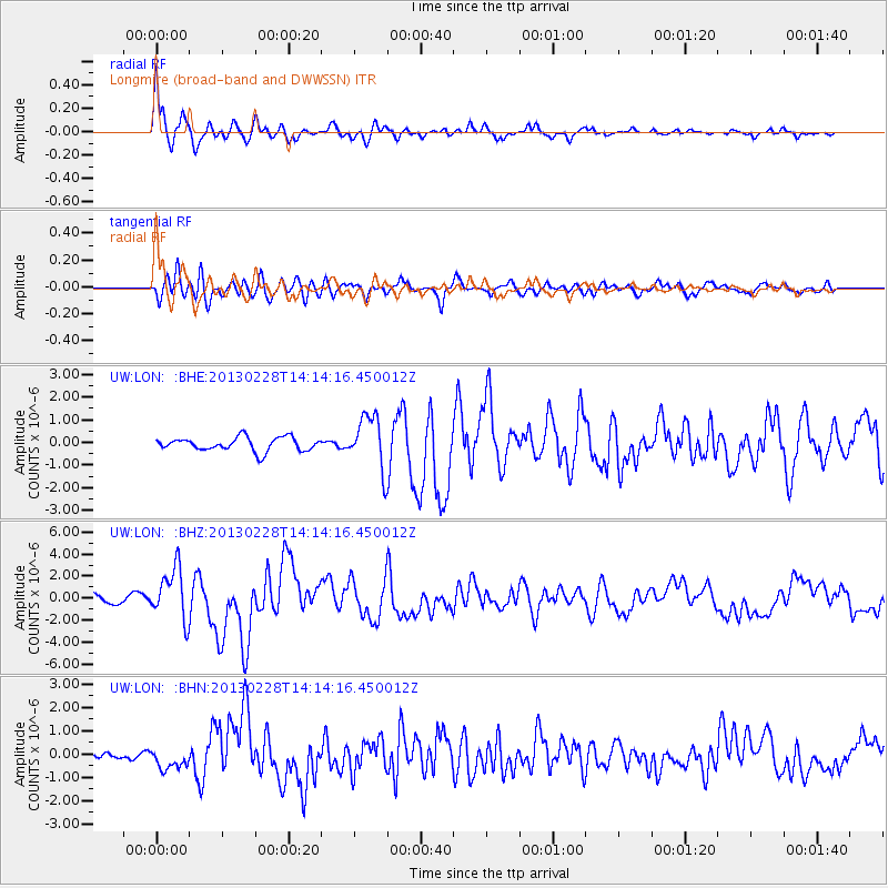
Earthquake location: Kuril Islands
Earthquake latitude/longitude: 51.0/157.3
Earthquake time(UTC): 2013/02/28 (059) 14:05:50 GMT
Earthquake Depth: 41 km
Earthquake Magnitude: 6.4 MB, 6.7 MS, 6.9 MW, 6.8 MW
Earthquake Catalog/Contributor: WHDF/NEIC
Network: UW Pacific Northwest Regional Seismic Network
Station: LON Longmire (broad-band and DWWSSN)
Lat/Lon: 46.75 N/121.81 W
Elevation: 850 m
Distance: 50.9 deg
Az: 61.084 deg
Baz: 306.375 deg
Ray Param: 0.0676828
Estimated Moho Depth: 13.0 km
Estimated Crust Vp/Vs: 1.60
Assumed Crust Vp: 6.597 km/s
Estimated Crust Vs: 4.123 km/s
Estimated Crust Poisson's Ratio: 0.18
Radial Match: 89.07563 %
Radial Bump: 339
Transverse Match: 74.23461 %
Transverse Bump: 400
SOD ConfigId: 494114
Insert Time: 2013-05-15 05:40:26.313 +0000
GWidth: 2.5
Max Bumps: 400
Tol: 0.001

Signal To Noise

ChannelStoNSTALTA
UW:LON: :BHZ:20130228T14:14:16.450012Z4.20874742.332205E-65.541328E-7
UW:LON: :BHN:20130228T14:14:16.450012Z1.87855574.3788089E-72.3309444E-7
UW:LON: :BHE:20130228T14:14:16.450012Z3.9666271.1778948E-62.9695124E-7
Arrivals
Ps1.3 SECOND
PpPs4.8 SECOND
PsPs/PpSs6.1 SECOND