You are here: Home > Network List > UW - Pacific Northwest Regional Seismic Network Stations List
> Station UMAT Pilot Rock, OR, USA > Earthquake Result Viewer
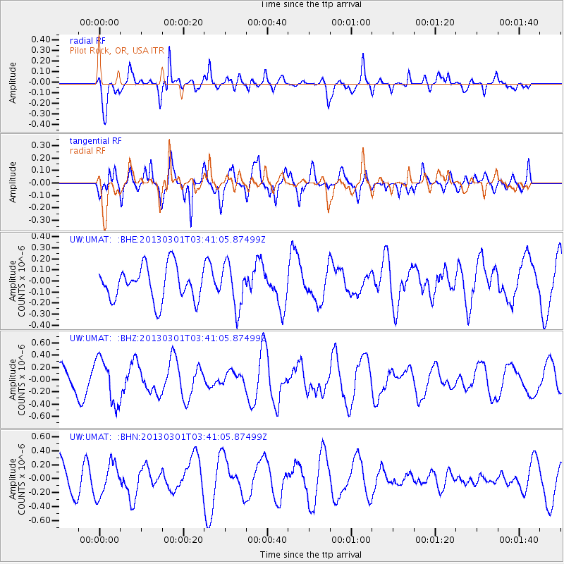
UMAT Pilot Rock, OR, USA - Earthquake Result Viewer
*The percent match for this event was below the threshold and hence no stack was calculated.
| Earthquake location: |
Mariana Islands Region |
| Earthquake latitude/longitude: |
21.8/144.0 |
| Earthquake time(UTC): |
2013/03/01 (060) 03:29:46 GMT |
| Earthquake Depth: |
153 km |
| Earthquake Magnitude: |
5.5 MW, 5.4 MW, 5.3 MB |
| Earthquake Catalog/Contributor: |
WHDF/NEIC |
|
| Network: |
UW Pacific Northwest Regional Seismic Network |
| Station: |
UMAT Pilot Rock, OR, USA |
| Lat/Lon: |
45.29 N/118.96 W |
| Elevation: |
1318 m |
|
| Distance: |
79.6 deg |
| Az: |
45.417 deg |
| Baz: |
290.292 deg |
| Ray Param: |
$rayparam |
*The percent match for this event was below the threshold and hence was not used in the summary stack. |
|
| Radial Match: |
62.216736 % |
| Radial Bump: |
400 |
| Transverse Match: |
68.39071 % |
| Transverse Bump: |
400 |
| SOD ConfigId: |
494114 |
| Insert Time: |
2013-05-15 05:55:06.852 +0000 |
| GWidth: |
2.5 |
| Max Bumps: |
400 |
| Tol: |
0.001 |
|
Signal To Noise
| Channel | StoN | STA | LTA |
| UW:UMAT: :BHZ:20130301T03:41:05.87499Z | 2.1780322 | 3.697851E-7 | 1.6977945E-7 |
| UW:UMAT: :BHN:20130301T03:41:05.87499Z | 1.1949679 | 2.3562157E-7 | 1.9717817E-7 |
| UW:UMAT: :BHE:20130301T03:41:05.87499Z | 1.3227842 | 1.9864886E-7 | 1.501748E-7 |
| Arrivals |
| Ps | |
| PpPs | |
| PsPs/PpSs | |


