You are here: Home > Network List > IW - Intermountain West Stations List
> Station MOOW Moose Ponds, Wyoming, USA > Earthquake Result Viewer
MOOW Moose Ponds, Wyoming, USA - Earthquake Result Viewer
*The percent match for this event was below the threshold and hence no stack was calculated.
| Earthquake location: |
Kuril Islands |
| Earthquake latitude/longitude: |
50.9/157.5 |
| Earthquake time(UTC): |
2013/03/01 (060) 12:53:51 GMT |
| Earthquake Depth: |
33 km |
| Earthquake Magnitude: |
5.7 MB, 5.8 MS, 6.4 MW, 6.4 MW |
| Earthquake Catalog/Contributor: |
WHDF/NEIC |
|
| Network: |
IW Intermountain West |
| Station: |
MOOW Moose Ponds, Wyoming, USA |
| Lat/Lon: |
43.75 N/110.74 W |
| Elevation: |
2128 m |
|
| Distance: |
58.7 deg |
| Az: |
57.92 deg |
| Baz: |
312.231 deg |
| Ray Param: |
$rayparam |
*The percent match for this event was below the threshold and hence was not used in the summary stack. |
|
| Radial Match: |
78.64699 % |
| Radial Bump: |
400 |
| Transverse Match: |
66.379364 % |
| Transverse Bump: |
400 |
| SOD ConfigId: |
494114 |
| Insert Time: |
2013-05-15 06:05:51.299 +0000 |
| GWidth: |
2.5 |
| Max Bumps: |
400 |
| Tol: |
0.001 |
|
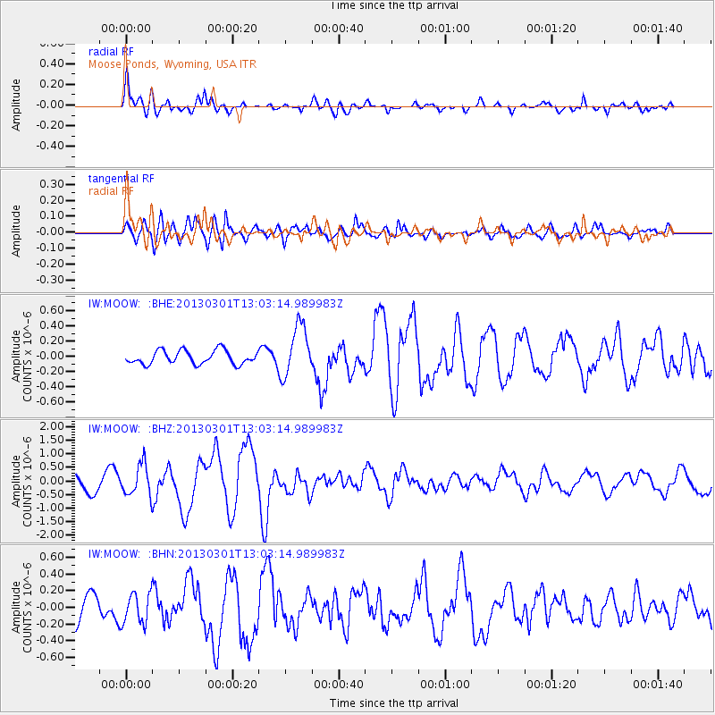
Signal To Noise
| Channel | StoN | STA | LTA |
| IW:MOOW: :BHZ:20130301T13:03:14.989983Z | 2.043747 | 5.7279277E-7 | 2.80266E-7 |
| IW:MOOW: :BHN:20130301T13:03:14.989983Z | 1.3711885 | 1.8305748E-7 | 1.3350278E-7 |
| IW:MOOW: :BHE:20130301T13:03:14.989983Z | 3.7937863 | 3.3649718E-7 | 8.869692E-8 |
| Arrivals |
| Ps | |
| PpPs | |
| PsPs/PpSs | |


