You are here: Home > Network List > TA - USArray Transportable Network (new EarthScope stations) Stations List
> Station N42A Yates City, IL, USA > Earthquake Result Viewer
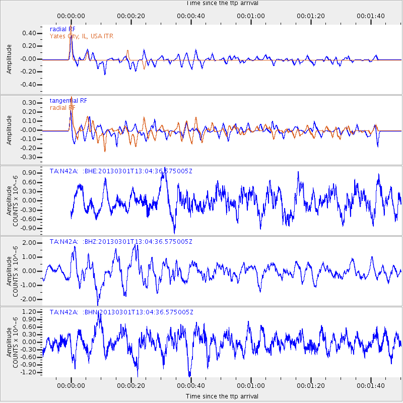
N42A Yates City, IL, USA - Earthquake Result Viewer
*The percent match for this event was below the threshold and hence no stack was calculated.
| Earthquake location: |
Kuril Islands |
| Earthquake latitude/longitude: |
50.9/157.5 |
| Earthquake time(UTC): |
2013/03/01 (060) 12:53:51 GMT |
| Earthquake Depth: |
33 km |
| Earthquake Magnitude: |
5.7 MB, 5.8 MS, 6.4 MW, 6.4 MW |
| Earthquake Catalog/Contributor: |
WHDF/NEIC |
|
| Network: |
TA USArray Transportable Network (new EarthScope stations) |
| Station: |
N42A Yates City, IL, USA |
| Lat/Lon: |
40.83 N/90.03 W |
| Elevation: |
205 m |
|
| Distance: |
71.3 deg |
| Az: |
47.725 deg |
| Baz: |
321.865 deg |
| Ray Param: |
$rayparam |
*The percent match for this event was below the threshold and hence was not used in the summary stack. |
|
| Radial Match: |
69.04072 % |
| Radial Bump: |
400 |
| Transverse Match: |
60.18087 % |
| Transverse Bump: |
400 |
| SOD ConfigId: |
494114 |
| Insert Time: |
2013-05-15 06:18:57.359 +0000 |
| GWidth: |
2.5 |
| Max Bumps: |
400 |
| Tol: |
0.001 |
|
Signal To Noise
| Channel | StoN | STA | LTA |
| TA:N42A: :BHZ:20130301T13:04:36.575005Z | 2.3383284 | 8.411928E-7 | 3.5974108E-7 |
| TA:N42A: :BHN:20130301T13:04:36.575005Z | 1.5022476 | 4.1295166E-7 | 2.7488923E-7 |
| TA:N42A: :BHE:20130301T13:04:36.575005Z | 2.2731702 | 6.468543E-7 | 2.8456043E-7 |
| Arrivals |
| Ps | |
| PpPs | |
| PsPs/PpSs | |


