You are here: Home > Network List > TA - USArray Transportable Network (new EarthScope stations) Stations List
> Station F39A Loretta, WI, USA > Earthquake Result Viewer
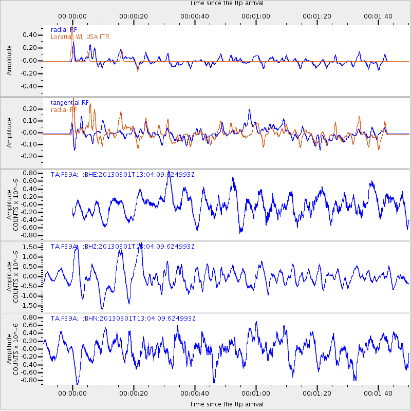
F39A Loretta, WI, USA - Earthquake Result Viewer
*The percent match for this event was below the threshold and hence no stack was calculated.
| Earthquake location: |
Kuril Islands |
| Earthquake latitude/longitude: |
50.9/157.5 |
| Earthquake time(UTC): |
2013/03/01 (060) 12:53:51 GMT |
| Earthquake Depth: |
33 km |
| Earthquake Magnitude: |
5.7 MB, 5.8 MS, 6.4 MW, 6.4 MW |
| Earthquake Catalog/Contributor: |
WHDF/NEIC |
|
| Network: |
TA USArray Transportable Network (new EarthScope stations) |
| Station: |
F39A Loretta, WI, USA |
| Lat/Lon: |
45.92 N/90.92 W |
| Elevation: |
440 m |
|
| Distance: |
67.0 deg |
| Az: |
44.842 deg |
| Baz: |
320.233 deg |
| Ray Param: |
$rayparam |
*The percent match for this event was below the threshold and hence was not used in the summary stack. |
|
| Radial Match: |
60.634857 % |
| Radial Bump: |
400 |
| Transverse Match: |
60.120083 % |
| Transverse Bump: |
400 |
| SOD ConfigId: |
494114 |
| Insert Time: |
2013-05-15 06:19:33.591 +0000 |
| GWidth: |
2.5 |
| Max Bumps: |
400 |
| Tol: |
0.001 |
|
Signal To Noise
| Channel | StoN | STA | LTA |
| TA:F39A: :BHZ:20130301T13:04:09.624993Z | 2.8159502 | 8.7333154E-7 | 3.1013744E-7 |
| TA:F39A: :BHN:20130301T13:04:09.624993Z | 1.4592419 | 4.517042E-7 | 3.0954718E-7 |
| TA:F39A: :BHE:20130301T13:04:09.624993Z | 2.137854 | 4.7331133E-7 | 2.2139552E-7 |
| Arrivals |
| Ps | |
| PpPs | |
| PsPs/PpSs | |


