You are here: Home > Network List > TA - USArray Transportable Network (new EarthScope stations) Stations List
> Station T46A Princeton, KY, USA > Earthquake Result Viewer
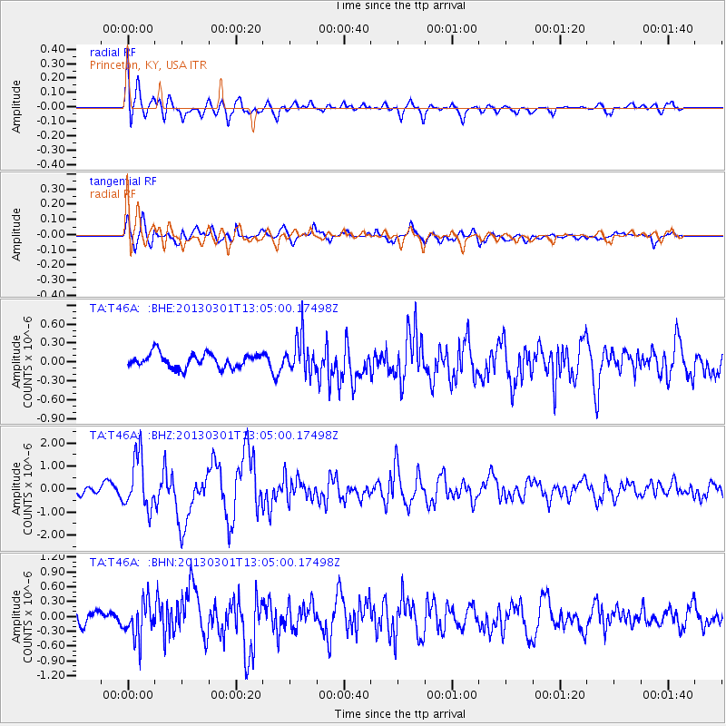
T46A Princeton, KY, USA - Earthquake Result Viewer
*The percent match for this event was below the threshold and hence no stack was calculated.
| Earthquake location: |
Kuril Islands |
| Earthquake latitude/longitude: |
50.9/157.5 |
| Earthquake time(UTC): |
2013/03/01 (060) 12:53:51 GMT |
| Earthquake Depth: |
33 km |
| Earthquake Magnitude: |
5.7 MB, 5.8 MS, 6.4 MW, 6.4 MW |
| Earthquake Catalog/Contributor: |
WHDF/NEIC |
|
| Network: |
TA USArray Transportable Network (new EarthScope stations) |
| Station: |
T46A Princeton, KY, USA |
| Lat/Lon: |
37.04 N/87.89 W |
| Elevation: |
169 m |
|
| Distance: |
75.4 deg |
| Az: |
48.732 deg |
| Baz: |
323.495 deg |
| Ray Param: |
$rayparam |
*The percent match for this event was below the threshold and hence was not used in the summary stack. |
|
| Radial Match: |
72.20889 % |
| Radial Bump: |
400 |
| Transverse Match: |
69.34594 % |
| Transverse Bump: |
400 |
| SOD ConfigId: |
494114 |
| Insert Time: |
2013-05-15 06:22:51.402 +0000 |
| GWidth: |
2.5 |
| Max Bumps: |
400 |
| Tol: |
0.001 |
|
Signal To Noise
| Channel | StoN | STA | LTA |
| TA:T46A: :BHZ:20130301T13:05:00.17498Z | 4.889894 | 1.1456875E-6 | 2.34297E-7 |
| TA:T46A: :BHN:20130301T13:05:00.17498Z | 1.6936378 | 3.6932778E-7 | 2.1806774E-7 |
| TA:T46A: :BHE:20130301T13:05:00.17498Z | 2.53671 | 2.834806E-7 | 1.11751284E-7 |
| Arrivals |
| Ps | |
| PpPs | |
| PsPs/PpSs | |


