You are here: Home > Network List > TA - USArray Transportable Network (new EarthScope stations) Stations List
> Station 154A Montrose, GA, USA > Earthquake Result Viewer
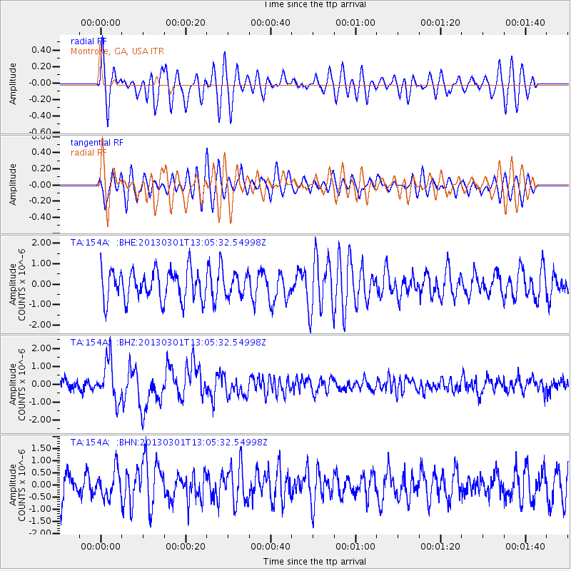
154A Montrose, GA, USA - Earthquake Result Viewer
*The percent match for this event was below the threshold and hence no stack was calculated.
| Earthquake location: |
Kuril Islands |
| Earthquake latitude/longitude: |
50.9/157.5 |
| Earthquake time(UTC): |
2013/03/01 (060) 12:53:51 GMT |
| Earthquake Depth: |
33 km |
| Earthquake Magnitude: |
5.7 MB, 5.8 MS, 6.4 MW, 6.4 MW |
| Earthquake Catalog/Contributor: |
WHDF/NEIC |
|
| Network: |
TA USArray Transportable Network (new EarthScope stations) |
| Station: |
154A Montrose, GA, USA |
| Lat/Lon: |
32.61 N/83.11 W |
| Elevation: |
111 m |
|
| Distance: |
81.2 deg |
| Az: |
48.045 deg |
| Baz: |
326.08 deg |
| Ray Param: |
$rayparam |
*The percent match for this event was below the threshold and hence was not used in the summary stack. |
|
| Radial Match: |
60.682888 % |
| Radial Bump: |
400 |
| Transverse Match: |
57.665855 % |
| Transverse Bump: |
400 |
| SOD ConfigId: |
494114 |
| Insert Time: |
2013-05-15 06:28:39.373 +0000 |
| GWidth: |
2.5 |
| Max Bumps: |
400 |
| Tol: |
0.001 |
|
Signal To Noise
| Channel | StoN | STA | LTA |
| TA:154A: :BHZ:20130301T13:05:32.54998Z | 4.3233166 | 1.1532532E-6 | 2.6675195E-7 |
| TA:154A: :BHN:20130301T13:05:32.54998Z | 1.0889635 | 5.743823E-7 | 5.2745776E-7 |
| TA:154A: :BHE:20130301T13:05:32.54998Z | 0.65317863 | 4.855343E-7 | 7.4334076E-7 |
| Arrivals |
| Ps | |
| PpPs | |
| PsPs/PpSs | |


