You are here: Home > Network List > GS - US Geological Survey Networks Stations List
> Station KAN10 Keim Farm > Earthquake Result Viewer
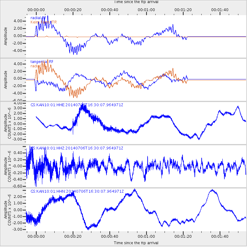
KAN10 Keim Farm - Earthquake Result Viewer
*The percent match for this event was below the threshold and hence no stack was calculated.
| Earthquake location: |
Northwest Of Kuril Islands |
| Earthquake latitude/longitude: |
47.7/147.5 |
| Earthquake time(UTC): |
2014/07/06 (187) 16:19:27 GMT |
| Earthquake Depth: |
399 km |
| Earthquake Magnitude: |
4.4 mb, 3.7 mb, 3.9 mb1, 3.8 mb1mx, 4.6 mbtmp |
| Earthquake Catalog/Contributor: |
ISC/ISC |
|
| Network: |
GS US Geological Survey Networks |
| Station: |
KAN10 Keim Farm |
| Lat/Lon: |
37.12 N/98.10 W |
| Elevation: |
417 m |
|
| Distance: |
77.3 deg |
| Az: |
48.233 deg |
| Baz: |
320.946 deg |
| Ray Param: |
$rayparam |
*The percent match for this event was below the threshold and hence was not used in the summary stack. |
|
| Radial Match: |
88.77307 % |
| Radial Bump: |
334 |
| Transverse Match: |
60.286484 % |
| Transverse Bump: |
400 |
| SOD ConfigId: |
3390531 |
| Insert Time: |
2019-04-12 17:36:27.668 +0000 |
| GWidth: |
2.5 |
| Max Bumps: |
400 |
| Tol: |
0.001 |
|
Signal To Noise
| Channel | StoN | STA | LTA |
| GS:KAN10:01:HHZ:20140706T16:30:07.964971Z | 1.1320277 | 2.1412909E-7 | 1.8915533E-7 |
| GS:KAN10:01:HHN:20140706T16:30:07.964971Z | 0.692687 | 8.399324E-7 | 1.2125713E-6 |
| GS:KAN10:01:HHE:20140706T16:30:07.964971Z | 1.2682652 | 1.2842129E-6 | 1.0125743E-6 |
| Arrivals |
| Ps | |
| PpPs | |
| PsPs/PpSs | |


