You are here: Home > Network List > TA - USArray Transportable Network (new EarthScope stations) Stations List
> Station G05D Wamic, OR, USA > Earthquake Result Viewer
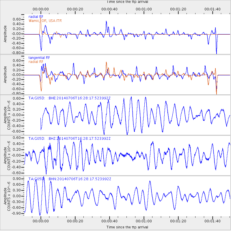
G05D Wamic, OR, USA - Earthquake Result Viewer
*The percent match for this event was below the threshold and hence no stack was calculated.
| Earthquake location: |
Northwest Of Kuril Islands |
| Earthquake latitude/longitude: |
47.7/147.5 |
| Earthquake time(UTC): |
2014/07/06 (187) 16:19:27 GMT |
| Earthquake Depth: |
399 km |
| Earthquake Magnitude: |
4.4 mb, 3.7 mb, 3.9 mb1, 3.8 mb1mx, 4.6 mbtmp |
| Earthquake Catalog/Contributor: |
ISC/ISC |
|
| Network: |
TA USArray Transportable Network (new EarthScope stations) |
| Station: |
G05D Wamic, OR, USA |
| Lat/Lon: |
45.24 N/121.32 W |
| Elevation: |
592 m |
|
| Distance: |
59.2 deg |
| Az: |
55.304 deg |
| Baz: |
308.211 deg |
| Ray Param: |
$rayparam |
*The percent match for this event was below the threshold and hence was not used in the summary stack. |
|
| Radial Match: |
61.59388 % |
| Radial Bump: |
400 |
| Transverse Match: |
66.006775 % |
| Transverse Bump: |
335 |
| SOD ConfigId: |
3390531 |
| Insert Time: |
2019-04-12 17:39:23.344 +0000 |
| GWidth: |
2.5 |
| Max Bumps: |
400 |
| Tol: |
0.001 |
|
Signal To Noise
| Channel | StoN | STA | LTA |
| TA:G05D: :BHZ:20140706T16:28:17.523992Z | 1.3709687 | 2.526689E-7 | 1.8429955E-7 |
| TA:G05D: :BHN:20140706T16:28:17.523992Z | 1.3854702 | 7.038281E-7 | 5.080067E-7 |
| TA:G05D: :BHE:20140706T16:28:17.523992Z | 1.140326 | 2.5674424E-7 | 2.2514985E-7 |
| Arrivals |
| Ps | |
| PpPs | |
| PsPs/PpSs | |


