
DBIC Dimbokro, Cote d'Ivoire - Earthquake Result Viewer
| ||||||||||||||||||
| ||||||||||||||||||
| ||||||||||||||||||
|
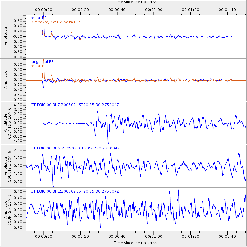
Signal To Noise
| Channel | StoN | STA | LTA |
| GT:DBIC:00:BHN:20050216T20:35:30.275004Z | 5.3509417 | 6.771254E-7 | 1.2654323E-7 |
| GT:DBIC:00:BHE:20050216T20:35:30.275004Z | 1.2515801 | 1.4605482E-7 | 1.1669634E-7 |
| GT:DBIC:00:BHZ:20050216T20:35:30.275004Z | 8.221874 | 1.0981428E-6 | 1.3356356E-7 |
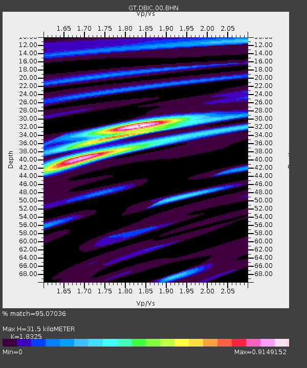
| Arrivals | |
| Ps | 4.4 SECOND |
| PpPs | 13 SECOND |
| PsPs/PpSs | 17 SECOND |

