You are here: Home > Network List > TA - USArray Transportable Network (new EarthScope stations) Stations List
> Station KSCO Kaye Shedlock's, Cheyenne Wells, CO, USA > Earthquake Result Viewer
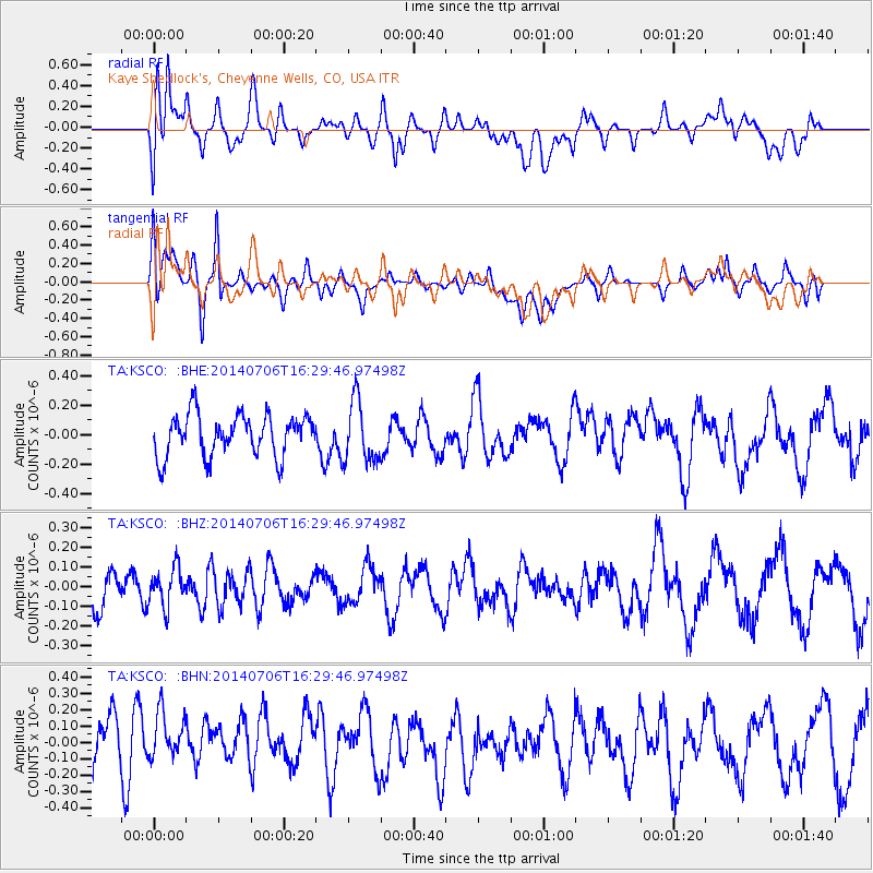
KSCO Kaye Shedlock's, Cheyenne Wells, CO, USA - Earthquake Result Viewer
*The percent match for this event was below the threshold and hence no stack was calculated.
| Earthquake location: |
Northwest Of Kuril Islands |
| Earthquake latitude/longitude: |
47.7/147.5 |
| Earthquake time(UTC): |
2014/07/06 (187) 16:19:27 GMT |
| Earthquake Depth: |
399 km |
| Earthquake Magnitude: |
4.4 mb, 3.7 mb, 3.9 mb1, 3.8 mb1mx, 4.6 mbtmp |
| Earthquake Catalog/Contributor: |
ISC/ISC |
|
| Network: |
TA USArray Transportable Network (new EarthScope stations) |
| Station: |
KSCO Kaye Shedlock's, Cheyenne Wells, CO, USA |
| Lat/Lon: |
39.01 N/102.63 W |
| Elevation: |
1382 m |
|
| Distance: |
73.5 deg |
| Az: |
49.796 deg |
| Baz: |
318.555 deg |
| Ray Param: |
$rayparam |
*The percent match for this event was below the threshold and hence was not used in the summary stack. |
|
| Radial Match: |
48.102283 % |
| Radial Bump: |
400 |
| Transverse Match: |
70.54738 % |
| Transverse Bump: |
400 |
| SOD ConfigId: |
3390531 |
| Insert Time: |
2019-04-12 17:39:41.285 +0000 |
| GWidth: |
2.5 |
| Max Bumps: |
400 |
| Tol: |
0.001 |
|
Signal To Noise
| Channel | StoN | STA | LTA |
| TA:KSCO: :BHZ:20140706T16:29:46.97498Z | 0.9915301 | 9.750832E-8 | 9.834125E-8 |
| TA:KSCO: :BHN:20140706T16:29:46.97498Z | 1.1268262 | 1.8511778E-7 | 1.6428245E-7 |
| TA:KSCO: :BHE:20140706T16:29:46.97498Z | 1.4823251 | 2.096813E-7 | 1.4145434E-7 |
| Arrivals |
| Ps | |
| PpPs | |
| PsPs/PpSs | |


