You are here: Home > Network List > TA - USArray Transportable Network (new EarthScope stations) Stations List
> Station W41B Gary Mavity, Velonia, AR, USA > Earthquake Result Viewer
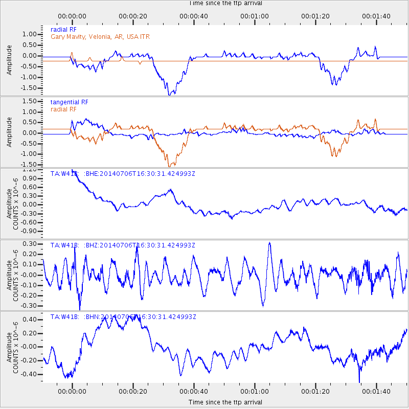
W41B Gary Mavity, Velonia, AR, USA - Earthquake Result Viewer
*The percent match for this event was below the threshold and hence no stack was calculated.
| Earthquake location: |
Northwest Of Kuril Islands |
| Earthquake latitude/longitude: |
47.7/147.5 |
| Earthquake time(UTC): |
2014/07/06 (187) 16:19:27 GMT |
| Earthquake Depth: |
399 km |
| Earthquake Magnitude: |
4.4 mb, 3.7 mb, 3.9 mb1, 3.8 mb1mx, 4.6 mbtmp |
| Earthquake Catalog/Contributor: |
ISC/ISC |
|
| Network: |
TA USArray Transportable Network (new EarthScope stations) |
| Station: |
W41B Gary Mavity, Velonia, AR, USA |
| Lat/Lon: |
35.17 N/92.25 W |
| Elevation: |
95 m |
|
| Distance: |
81.7 deg |
| Az: |
45.625 deg |
| Baz: |
323.907 deg |
| Ray Param: |
$rayparam |
*The percent match for this event was below the threshold and hence was not used in the summary stack. |
|
| Radial Match: |
19.710136 % |
| Radial Bump: |
400 |
| Transverse Match: |
22.835196 % |
| Transverse Bump: |
400 |
| SOD ConfigId: |
3390531 |
| Insert Time: |
2019-04-12 17:40:13.275 +0000 |
| GWidth: |
2.5 |
| Max Bumps: |
400 |
| Tol: |
0.001 |
|
Signal To Noise
| Channel | StoN | STA | LTA |
| TA:W41B: :BHZ:20140706T16:30:31.424993Z | 1.334442 | 1.4871868E-7 | 1.1144635E-7 |
| TA:W41B: :BHN:20140706T16:30:31.424993Z | 1.0692062 | 2.5187498E-7 | 2.3557193E-7 |
| TA:W41B: :BHE:20140706T16:30:31.424993Z | 0.4426243 | 1.5845642E-7 | 3.5799303E-7 |
| Arrivals |
| Ps | |
| PpPs | |
| PsPs/PpSs | |


