You are here: Home > Network List > TA - USArray Transportable Network (new EarthScope stations) Stations List
> Station R41A Rosebud, MO, USA > Earthquake Result Viewer
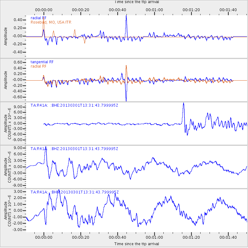
R41A Rosebud, MO, USA - Earthquake Result Viewer
*The percent match for this event was below the threshold and hence no stack was calculated.
| Earthquake location: |
Kuril Islands |
| Earthquake latitude/longitude: |
51.0/157.4 |
| Earthquake time(UTC): |
2013/03/01 (060) 13:20:49 GMT |
| Earthquake Depth: |
29 km |
| Earthquake Magnitude: |
6.3 MB, 6.3 MS, 6.5 MW, 6.4 MW |
| Earthquake Catalog/Contributor: |
WHDF/NEIC |
|
| Network: |
TA USArray Transportable Network (new EarthScope stations) |
| Station: |
R41A Rosebud, MO, USA |
| Lat/Lon: |
38.30 N/91.38 W |
| Elevation: |
257 m |
|
| Distance: |
72.7 deg |
| Az: |
50.213 deg |
| Baz: |
321.855 deg |
| Ray Param: |
$rayparam |
*The percent match for this event was below the threshold and hence was not used in the summary stack. |
|
| Radial Match: |
86.121666 % |
| Radial Bump: |
400 |
| Transverse Match: |
82.886894 % |
| Transverse Bump: |
400 |
| SOD ConfigId: |
494114 |
| Insert Time: |
2013-05-15 07:12:07.857 +0000 |
| GWidth: |
2.5 |
| Max Bumps: |
400 |
| Tol: |
0.001 |
|
Signal To Noise
| Channel | StoN | STA | LTA |
| TA:R41A: :BHZ:20130301T13:31:43.799995Z | 5.08425 | 4.4217527E-6 | 8.696962E-7 |
| TA:R41A: :BHN:20130301T13:31:43.799995Z | 1.5927535 | 1.4799496E-6 | 9.2917674E-7 |
| TA:R41A: :BHE:20130301T13:31:43.799995Z | 1.3140075 | 3.8690138E-7 | 2.944438E-7 |
| Arrivals |
| Ps | |
| PpPs | |
| PsPs/PpSs | |


