You are here: Home > Network List > TA - USArray Transportable Network (new EarthScope stations) Stations List
> Station D50A G1974 Best Township, ON, CAN > Earthquake Result Viewer
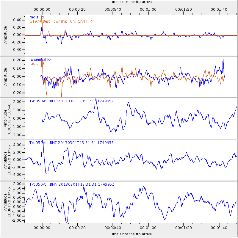
D50A G1974 Best Township, ON, CAN - Earthquake Result Viewer
*The percent match for this event was below the threshold and hence no stack was calculated.
| Earthquake location: |
Kuril Islands |
| Earthquake latitude/longitude: |
51.0/157.4 |
| Earthquake time(UTC): |
2013/03/01 (060) 13:20:49 GMT |
| Earthquake Depth: |
29 km |
| Earthquake Magnitude: |
6.3 MB, 6.3 MS, 6.5 MW, 6.4 MW |
| Earthquake Catalog/Contributor: |
WHDF/NEIC |
|
| Network: |
TA USArray Transportable Network (new EarthScope stations) |
| Station: |
D50A G1974 Best Township, ON, CAN |
| Lat/Lon: |
47.17 N/79.84 W |
| Elevation: |
331 m |
|
| Distance: |
70.6 deg |
| Az: |
37.485 deg |
| Baz: |
325.663 deg |
| Ray Param: |
$rayparam |
*The percent match for this event was below the threshold and hence was not used in the summary stack. |
|
| Radial Match: |
72.17992 % |
| Radial Bump: |
286 |
| Transverse Match: |
60.66199 % |
| Transverse Bump: |
311 |
| SOD ConfigId: |
494114 |
| Insert Time: |
2013-05-15 07:32:57.614 +0000 |
| GWidth: |
2.5 |
| Max Bumps: |
400 |
| Tol: |
0.001 |
|
Signal To Noise
| Channel | StoN | STA | LTA |
| TA:D50A: :BHZ:20130301T13:31:31.174995Z | 4.672437 | 2.7194533E-6 | 5.820203E-7 |
| TA:D50A: :BHN:20130301T13:31:31.174995Z | 2.2033908 | 6.788719E-7 | 3.0810327E-7 |
| TA:D50A: :BHE:20130301T13:31:31.174995Z | 2.8999078 | 1.2171025E-6 | 4.197039E-7 |
| Arrivals |
| Ps | |
| PpPs | |
| PsPs/PpSs | |


