You are here: Home > Network List > TA - USArray Transportable Network (new EarthScope stations) Stations List
> Station J04D Umpqua National Forest, Toketee, OR, USA > Earthquake Result Viewer
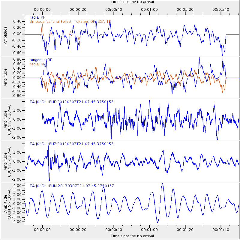
J04D Umpqua National Forest, Toketee, OR, USA - Earthquake Result Viewer
*The percent match for this event was below the threshold and hence no stack was calculated.
| Earthquake location: |
Vanuatu Islands |
| Earthquake latitude/longitude: |
-19.0/169.4 |
| Earthquake time(UTC): |
2013/03/07 (066) 20:55:52 GMT |
| Earthquake Depth: |
236 km |
| Earthquake Magnitude: |
5.5 MB, 5.5 MW, 5.5 MW |
| Earthquake Catalog/Contributor: |
WHDF/NEIC |
|
| Network: |
TA USArray Transportable Network (new EarthScope stations) |
| Station: |
J04D Umpqua National Forest, Toketee, OR, USA |
| Lat/Lon: |
43.24 N/122.11 W |
| Elevation: |
1948 m |
|
| Distance: |
88.1 deg |
| Az: |
42.871 deg |
| Baz: |
241.771 deg |
| Ray Param: |
$rayparam |
*The percent match for this event was below the threshold and hence was not used in the summary stack. |
|
| Radial Match: |
42.504234 % |
| Radial Bump: |
400 |
| Transverse Match: |
52.126495 % |
| Transverse Bump: |
328 |
| SOD ConfigId: |
494114 |
| Insert Time: |
2013-05-18 05:06:20.836 +0000 |
| GWidth: |
2.5 |
| Max Bumps: |
400 |
| Tol: |
0.001 |
|
Signal To Noise
| Channel | StoN | STA | LTA |
| TA:J04D: :BHZ:20130307T21:07:45.375015Z | 2.8557088 | 8.74265E-7 | 3.061464E-7 |
| TA:J04D: :BHN:20130307T21:07:45.375015Z | 1.325622 | 2.122659E-6 | 1.6012551E-6 |
| TA:J04D: :BHE:20130307T21:07:45.375015Z | 0.9027873 | 5.5951756E-7 | 6.1976675E-7 |
| Arrivals |
| Ps | |
| PpPs | |
| PsPs/PpSs | |


