You are here: Home > Network List > CN - Canadian National Seismograph Network Stations List
> Station INK INUVIK, NT > Earthquake Result Viewer
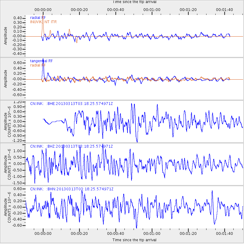
INK INUVIK, NT - Earthquake Result Viewer
*The percent match for this event was below the threshold and hence no stack was calculated.
| Earthquake location: |
South Pacific Ocean |
| Earthquake latitude/longitude: |
-8.8/-131.9 |
| Earthquake time(UTC): |
2013/03/13 (072) 03:07:04 GMT |
| Earthquake Depth: |
10 km |
| Earthquake Magnitude: |
5.5 MB, 5.3 MS |
| Earthquake Catalog/Contributor: |
WHDF/NEIC |
|
| Network: |
CN Canadian National Seismograph Network |
| Station: |
INK INUVIK, NT |
| Lat/Lon: |
68.31 N/133.53 W |
| Elevation: |
44 m |
|
| Distance: |
76.9 deg |
| Az: |
359.388 deg |
| Baz: |
178.372 deg |
| Ray Param: |
$rayparam |
*The percent match for this event was below the threshold and hence was not used in the summary stack. |
|
| Radial Match: |
62.474537 % |
| Radial Bump: |
400 |
| Transverse Match: |
81.4477 % |
| Transverse Bump: |
389 |
| SOD ConfigId: |
506122 |
| Insert Time: |
2013-05-26 03:11:04.633 +0000 |
| GWidth: |
2.5 |
| Max Bumps: |
400 |
| Tol: |
0.001 |
|
Signal To Noise
| Channel | StoN | STA | LTA |
| CN:INK: :BHZ:20130313T03:18:25.574971Z | 1.1344379 | 7.260187E-7 | 6.3998095E-7 |
| CN:INK: :BHN:20130313T03:18:25.574971Z | 1.8812689 | 1.9662524E-7 | 1.0451735E-7 |
| CN:INK: :BHE:20130313T03:18:25.574971Z | 1.3683903 | 4.6184766E-7 | 3.3751164E-7 |
| Arrivals |
| Ps | |
| PpPs | |
| PsPs/PpSs | |


