You are here: Home > Network List > BK - Berkeley Digital Seismograph Network Stations List
> Station HUMO Hull Mountain, OR > Earthquake Result Viewer
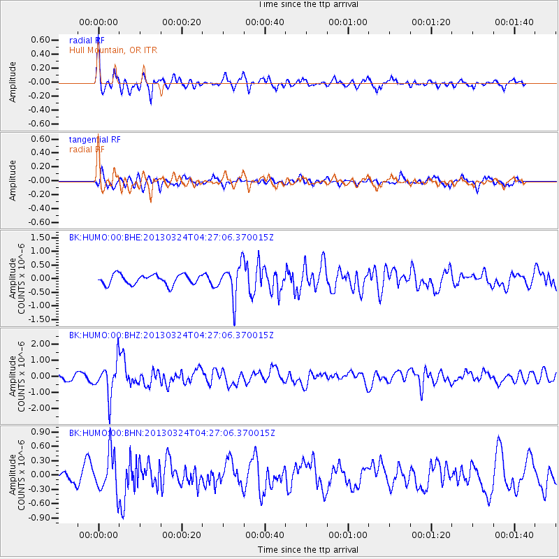
HUMO Hull Mountain, OR - Earthquake Result Viewer
*The percent match for this event was below the threshold and hence no stack was calculated.
| Earthquake location: |
East Of Kuril Islands |
| Earthquake latitude/longitude: |
50.7/160.2 |
| Earthquake time(UTC): |
2013/03/24 (083) 04:18:33 GMT |
| Earthquake Depth: |
8.0 km |
| Earthquake Magnitude: |
6.1 MB, 5.5 MS, 5.9 MW, 6.1 MW |
| Earthquake Catalog/Contributor: |
WHDF/NEIC |
|
| Network: |
BK Berkeley Digital Seismograph Network |
| Station: |
HUMO Hull Mountain, OR |
| Lat/Lon: |
42.61 N/122.96 W |
| Elevation: |
555 m |
|
| Distance: |
51.2 deg |
| Az: |
67.4 deg |
| Baz: |
307.373 deg |
| Ray Param: |
$rayparam |
*The percent match for this event was below the threshold and hence was not used in the summary stack. |
|
| Radial Match: |
77.25364 % |
| Radial Bump: |
400 |
| Transverse Match: |
60.98585 % |
| Transverse Bump: |
400 |
| SOD ConfigId: |
506122 |
| Insert Time: |
2013-06-01 12:57:47.406 +0000 |
| GWidth: |
2.5 |
| Max Bumps: |
400 |
| Tol: |
0.001 |
|
Signal To Noise
| Channel | StoN | STA | LTA |
| BK:HUMO:00:BHZ:20130324T04:27:06.370015Z | 7.5067844 | 1.0801268E-6 | 1.4388677E-7 |
| BK:HUMO:00:BHN:20130324T04:27:06.370015Z | 3.6217425 | 4.2651067E-7 | 1.1776394E-7 |
| BK:HUMO:00:BHE:20130324T04:27:06.370015Z | 3.4533052 | 6.3147525E-7 | 1.828611E-7 |
| Arrivals |
| Ps | |
| PpPs | |
| PsPs/PpSs | |


