You are here: Home > Network List > CI - Caltech Regional Seismic Network Stations List
> Station SMM Simmler, CA, USA > Earthquake Result Viewer
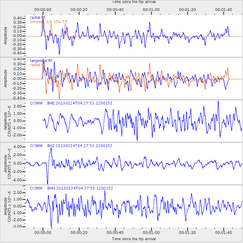
SMM Simmler, CA, USA - Earthquake Result Viewer
*The percent match for this event was below the threshold and hence no stack was calculated.
| Earthquake location: |
East Of Kuril Islands |
| Earthquake latitude/longitude: |
50.7/160.2 |
| Earthquake time(UTC): |
2013/03/24 (083) 04:18:33 GMT |
| Earthquake Depth: |
8.0 km |
| Earthquake Magnitude: |
6.1 MB, 5.5 MS, 5.9 MW, 6.1 MW |
| Earthquake Catalog/Contributor: |
WHDF/NEIC |
|
| Network: |
CI Caltech Regional Seismic Network |
| Station: |
SMM Simmler, CA, USA |
| Lat/Lon: |
35.31 N/120.00 W |
| Elevation: |
599 m |
|
| Distance: |
57.6 deg |
| Az: |
72.463 deg |
| Baz: |
312.187 deg |
| Ray Param: |
$rayparam |
*The percent match for this event was below the threshold and hence was not used in the summary stack. |
|
| Radial Match: |
62.024345 % |
| Radial Bump: |
400 |
| Transverse Match: |
58.263573 % |
| Transverse Bump: |
400 |
| SOD ConfigId: |
506122 |
| Insert Time: |
2013-06-01 13:01:09.315 +0000 |
| GWidth: |
2.5 |
| Max Bumps: |
400 |
| Tol: |
0.001 |
|
Signal To Noise
| Channel | StoN | STA | LTA |
| CI:SMM: :BHZ:20130324T04:27:53.120015Z | 3.9743497 | 2.065693E-6 | 5.197562E-7 |
| CI:SMM: :BHN:20130324T04:27:53.120015Z | 1.7432164 | 1.0568737E-6 | 6.062779E-7 |
| CI:SMM: :BHE:20130324T04:27:53.120015Z | 1.3759304 | 8.568056E-7 | 6.2271E-7 |
| Arrivals |
| Ps | |
| PpPs | |
| PsPs/PpSs | |


