You are here: Home > Network List > CI - Caltech Regional Seismic Network Stations List
> Station MPP McPhearson Peak > Earthquake Result Viewer
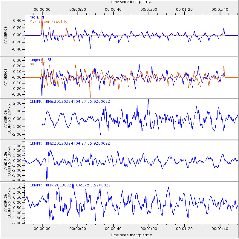
MPP McPhearson Peak - Earthquake Result Viewer
*The percent match for this event was below the threshold and hence no stack was calculated.
| Earthquake location: |
East Of Kuril Islands |
| Earthquake latitude/longitude: |
50.7/160.2 |
| Earthquake time(UTC): |
2013/03/24 (083) 04:18:33 GMT |
| Earthquake Depth: |
8.0 km |
| Earthquake Magnitude: |
6.1 MB, 5.5 MS, 5.9 MW, 6.1 MW |
| Earthquake Catalog/Contributor: |
WHDF/NEIC |
|
| Network: |
CI Caltech Regional Seismic Network |
| Station: |
MPP McPhearson Peak |
| Lat/Lon: |
34.89 N/119.81 W |
| Elevation: |
1739 m |
|
| Distance: |
58.0 deg |
| Az: |
72.715 deg |
| Baz: |
312.426 deg |
| Ray Param: |
$rayparam |
*The percent match for this event was below the threshold and hence was not used in the summary stack. |
|
| Radial Match: |
40.52568 % |
| Radial Bump: |
386 |
| Transverse Match: |
62.77914 % |
| Transverse Bump: |
400 |
| SOD ConfigId: |
506122 |
| Insert Time: |
2013-06-01 13:01:33.333 +0000 |
| GWidth: |
2.5 |
| Max Bumps: |
400 |
| Tol: |
0.001 |
|
Signal To Noise
| Channel | StoN | STA | LTA |
| CI:MPP: :BHZ:20130324T04:27:55.920002Z | 3.1669123 | 1.5408046E-6 | 4.8653214E-7 |
| CI:MPP: :BHN:20130324T04:27:55.920002Z | 1.6990014 | 6.66412E-7 | 3.9223747E-7 |
| CI:MPP: :BHE:20130324T04:27:55.920002Z | 1.2054161 | 7.0671865E-7 | 5.8628603E-7 |
| Arrivals |
| Ps | |
| PpPs | |
| PsPs/PpSs | |


