You are here: Home > Network List > CI - Caltech Regional Seismic Network Stations List
> Station MPM Manuel Prospect Mine, California, USA > Earthquake Result Viewer
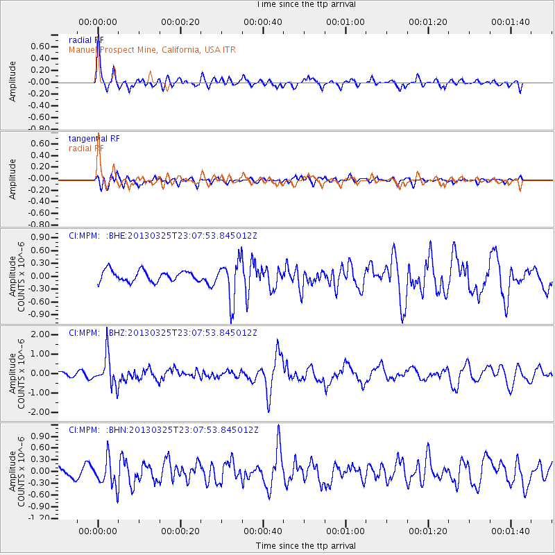
MPM Manuel Prospect Mine, California, USA - Earthquake Result Viewer
*The percent match for this event was below the threshold and hence no stack was calculated.
| Earthquake location: |
Guatemala |
| Earthquake latitude/longitude: |
14.5/-90.5 |
| Earthquake time(UTC): |
2013/03/25 (084) 23:02:12 GMT |
| Earthquake Depth: |
189 km |
| Earthquake Magnitude: |
6.2 MB, 6.2 MW, 6.2 MW |
| Earthquake Catalog/Contributor: |
WHDF/NEIC |
|
| Network: |
CI Caltech Regional Seismic Network |
| Station: |
MPM Manuel Prospect Mine, California, USA |
| Lat/Lon: |
36.06 N/117.49 W |
| Elevation: |
185 m |
|
| Distance: |
32.3 deg |
| Az: |
316.514 deg |
| Baz: |
124.651 deg |
| Ray Param: |
$rayparam |
*The percent match for this event was below the threshold and hence was not used in the summary stack. |
|
| Radial Match: |
79.91253 % |
| Radial Bump: |
400 |
| Transverse Match: |
70.14433 % |
| Transverse Bump: |
400 |
| SOD ConfigId: |
506627 |
| Insert Time: |
2013-06-01 13:14:41.298 +0000 |
| GWidth: |
2.5 |
| Max Bumps: |
400 |
| Tol: |
0.001 |
|
Signal To Noise
| Channel | StoN | STA | LTA |
| CI:MPM: :BHZ:20130325T23:07:53.845012Z | 5.2135844 | 8.2356854E-7 | 1.579659E-7 |
| CI:MPM: :BHN:20130325T23:07:53.845012Z | 2.5019062 | 3.6080186E-7 | 1.4421079E-7 |
| CI:MPM: :BHE:20130325T23:07:53.845012Z | 3.8768647 | 4.8629477E-7 | 1.2543507E-7 |
| Arrivals |
| Ps | |
| PpPs | |
| PsPs/PpSs | |


