You are here: Home > Network List > CI - Caltech Regional Seismic Network Stations List
> Station SMM Simmler, CA, USA > Earthquake Result Viewer
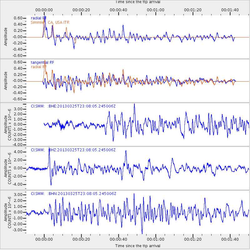
SMM Simmler, CA, USA - Earthquake Result Viewer
*The percent match for this event was below the threshold and hence no stack was calculated.
| Earthquake location: |
Guatemala |
| Earthquake latitude/longitude: |
14.5/-90.5 |
| Earthquake time(UTC): |
2013/03/25 (084) 23:02:12 GMT |
| Earthquake Depth: |
189 km |
| Earthquake Magnitude: |
6.2 MB, 6.2 MW, 6.2 MW |
| Earthquake Catalog/Contributor: |
WHDF/NEIC |
|
| Network: |
CI Caltech Regional Seismic Network |
| Station: |
SMM Simmler, CA, USA |
| Lat/Lon: |
35.31 N/120.00 W |
| Elevation: |
599 m |
|
| Distance: |
33.7 deg |
| Az: |
313.348 deg |
| Baz: |
120.54 deg |
| Ray Param: |
$rayparam |
*The percent match for this event was below the threshold and hence was not used in the summary stack. |
|
| Radial Match: |
76.047516 % |
| Radial Bump: |
400 |
| Transverse Match: |
68.7174 % |
| Transverse Bump: |
400 |
| SOD ConfigId: |
506627 |
| Insert Time: |
2013-06-01 13:15:31.420 +0000 |
| GWidth: |
2.5 |
| Max Bumps: |
400 |
| Tol: |
0.001 |
|
Signal To Noise
| Channel | StoN | STA | LTA |
| CI:SMM: :BHZ:20130325T23:08:05.245006Z | 7.2598586 | 1.9077938E-6 | 2.6278664E-7 |
| CI:SMM: :BHN:20130325T23:08:05.245006Z | 1.9439561 | 5.4606517E-7 | 2.8090406E-7 |
| CI:SMM: :BHE:20130325T23:08:05.245006Z | 2.1004298 | 8.359838E-7 | 3.9800608E-7 |
| Arrivals |
| Ps | |
| PpPs | |
| PsPs/PpSs | |


