You are here: Home > Network List > TA - USArray Transportable Network (new EarthScope stations) Stations List
> Station M47A Cromwell, IN, USA > Earthquake Result Viewer
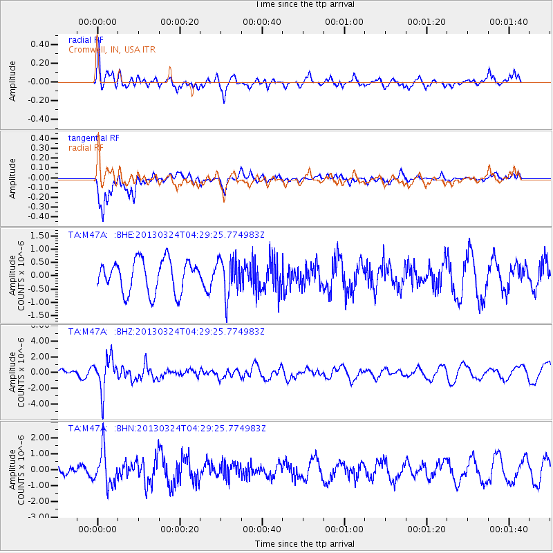
M47A Cromwell, IN, USA - Earthquake Result Viewer
*The percent match for this event was below the threshold and hence no stack was calculated.
| Earthquake location: |
East Of Kuril Islands |
| Earthquake latitude/longitude: |
50.7/160.2 |
| Earthquake time(UTC): |
2013/03/24 (083) 04:18:33 GMT |
| Earthquake Depth: |
8.0 km |
| Earthquake Magnitude: |
6.1 MB, 5.5 MS, 5.9 MW, 6.1 MW |
| Earthquake Catalog/Contributor: |
WHDF/NEIC |
|
| Network: |
TA USArray Transportable Network (new EarthScope stations) |
| Station: |
M47A Cromwell, IN, USA |
| Lat/Lon: |
41.36 N/85.62 W |
| Elevation: |
283 m |
|
| Distance: |
71.8 deg |
| Az: |
46.268 deg |
| Baz: |
322.409 deg |
| Ray Param: |
$rayparam |
*The percent match for this event was below the threshold and hence was not used in the summary stack. |
|
| Radial Match: |
48.096394 % |
| Radial Bump: |
400 |
| Transverse Match: |
72.44744 % |
| Transverse Bump: |
400 |
| SOD ConfigId: |
506122 |
| Insert Time: |
2013-06-01 13:33:52.941 +0000 |
| GWidth: |
2.5 |
| Max Bumps: |
400 |
| Tol: |
0.001 |
|
Signal To Noise
| Channel | StoN | STA | LTA |
| TA:M47A: :BHZ:20130324T04:29:25.774983Z | 3.6533558 | 2.1391104E-6 | 5.855193E-7 |
| TA:M47A: :BHN:20130324T04:29:25.774983Z | 2.4690065 | 1.1124122E-6 | 4.5055052E-7 |
| TA:M47A: :BHE:20130324T04:29:25.774983Z | 1.1725407 | 7.0473106E-7 | 6.010291E-7 |
| Arrivals |
| Ps | |
| PpPs | |
| PsPs/PpSs | |


