You are here: Home > Network List > UW - Pacific Northwest Regional Seismic Network Stations List
> Station FISH Seaside, OR, USA > Earthquake Result Viewer
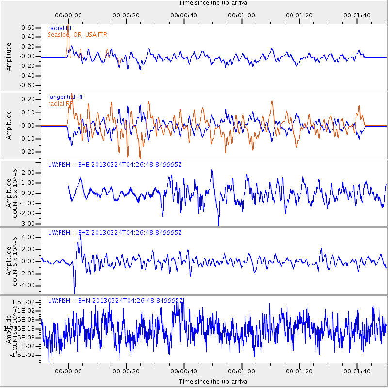
FISH Seaside, OR, USA - Earthquake Result Viewer
*The percent match for this event was below the threshold and hence no stack was calculated.
| Earthquake location: |
East Of Kuril Islands |
| Earthquake latitude/longitude: |
50.7/160.2 |
| Earthquake time(UTC): |
2013/03/24 (083) 04:18:33 GMT |
| Earthquake Depth: |
8.0 km |
| Earthquake Magnitude: |
6.1 MB, 5.5 MS, 5.9 MW, 6.1 MW |
| Earthquake Catalog/Contributor: |
WHDF/NEIC |
|
| Network: |
UW Pacific Northwest Regional Seismic Network |
| Station: |
FISH Seaside, OR, USA |
| Lat/Lon: |
45.93 N/123.56 W |
| Elevation: |
325 m |
|
| Distance: |
48.8 deg |
| Az: |
64.23 deg |
| Baz: |
304.916 deg |
| Ray Param: |
$rayparam |
*The percent match for this event was below the threshold and hence was not used in the summary stack. |
|
| Radial Match: |
68.53213 % |
| Radial Bump: |
400 |
| Transverse Match: |
68.39058 % |
| Transverse Bump: |
400 |
| SOD ConfigId: |
506122 |
| Insert Time: |
2013-06-01 13:44:05.296 +0000 |
| GWidth: |
2.5 |
| Max Bumps: |
400 |
| Tol: |
0.001 |
|
Signal To Noise
| Channel | StoN | STA | LTA |
| UW:FISH: :BHZ:20130324T04:26:48.849995Z | 6.9766884 | 2.1754506E-6 | 3.118171E-7 |
| UW:FISH: :BHN:20130324T04:26:48.849995Z | 0.6719942 | 4.702684E-9 | 6.9981025E-9 |
| UW:FISH: :BHE:20130324T04:26:48.849995Z | 1.7990546 | 8.566541E-7 | 4.7616902E-7 |
| Arrivals |
| Ps | |
| PpPs | |
| PsPs/PpSs | |


