You are here: Home > Network List > TA - USArray Transportable Network (new EarthScope stations) Stations List
> Station E41A Kenton, MI, USA > Earthquake Result Viewer
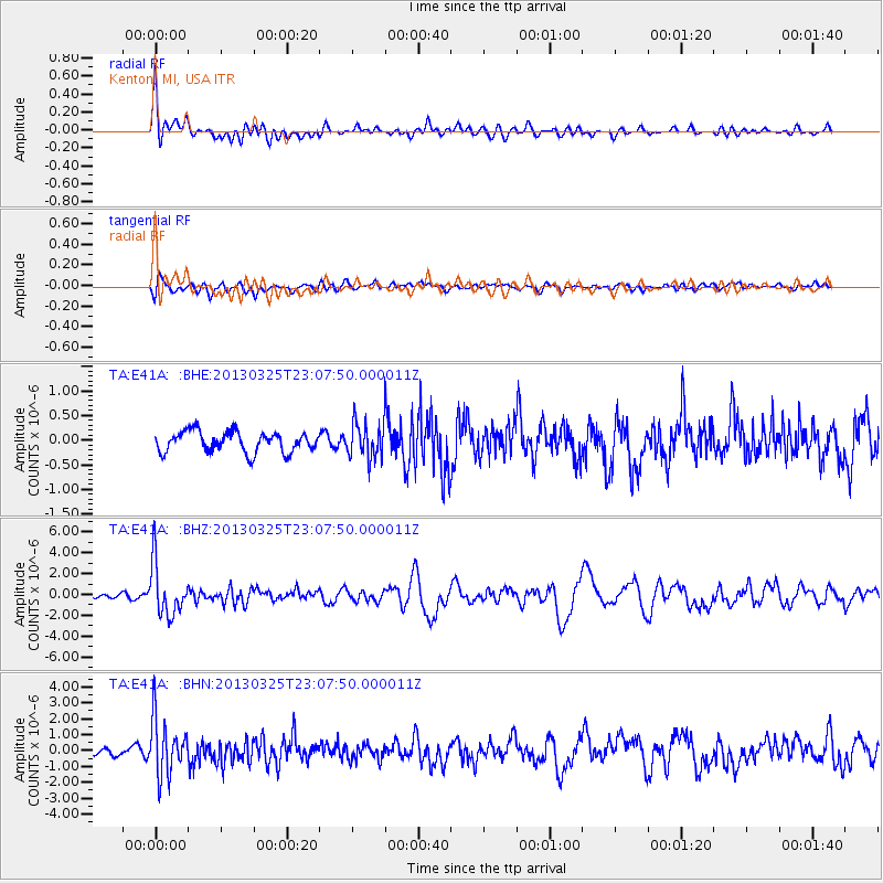
E41A Kenton, MI, USA - Earthquake Result Viewer
*The percent match for this event was below the threshold and hence no stack was calculated.
| Earthquake location: |
Guatemala |
| Earthquake latitude/longitude: |
14.5/-90.5 |
| Earthquake time(UTC): |
2013/03/25 (084) 23:02:12 GMT |
| Earthquake Depth: |
189 km |
| Earthquake Magnitude: |
6.2 MB, 6.2 MW, 6.2 MW |
| Earthquake Catalog/Contributor: |
WHDF/NEIC |
|
| Network: |
TA USArray Transportable Network (new EarthScope stations) |
| Station: |
E41A Kenton, MI, USA |
| Lat/Lon: |
46.46 N/88.96 W |
| Elevation: |
377 m |
|
| Distance: |
31.9 deg |
| Az: |
1.961 deg |
| Baz: |
182.749 deg |
| Ray Param: |
$rayparam |
*The percent match for this event was below the threshold and hence was not used in the summary stack. |
|
| Radial Match: |
77.85917 % |
| Radial Bump: |
400 |
| Transverse Match: |
57.49162 % |
| Transverse Bump: |
400 |
| SOD ConfigId: |
506122 |
| Insert Time: |
2013-06-01 13:57:23.963 +0000 |
| GWidth: |
2.5 |
| Max Bumps: |
400 |
| Tol: |
0.001 |
|
Signal To Noise
| Channel | StoN | STA | LTA |
| TA:E41A: :BHZ:20130325T23:07:50.000011Z | 9.643592 | 2.437788E-6 | 2.527884E-7 |
| TA:E41A: :BHN:20130325T23:07:50.000011Z | 7.2980566 | 1.7378355E-6 | 2.3812305E-7 |
| TA:E41A: :BHE:20130325T23:07:50.000011Z | 1.7681605 | 3.6608884E-7 | 2.0704503E-7 |
| Arrivals |
| Ps | |
| PpPs | |
| PsPs/PpSs | |


