You are here: Home > Network List > TA - USArray Transportable Network (new EarthScope stations) Stations List
> Station I49A Point Hope, MI, USA > Earthquake Result Viewer
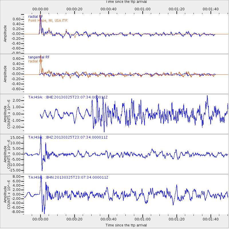
I49A Point Hope, MI, USA - Earthquake Result Viewer
*The percent match for this event was below the threshold and hence no stack was calculated.
| Earthquake location: |
Guatemala |
| Earthquake latitude/longitude: |
14.5/-90.5 |
| Earthquake time(UTC): |
2013/03/25 (084) 23:02:12 GMT |
| Earthquake Depth: |
189 km |
| Earthquake Magnitude: |
6.2 MB, 6.2 MW, 6.2 MW |
| Earthquake Catalog/Contributor: |
WHDF/NEIC |
|
| Network: |
TA USArray Transportable Network (new EarthScope stations) |
| Station: |
I49A Point Hope, MI, USA |
| Lat/Lon: |
43.94 N/82.82 W |
| Elevation: |
217 m |
|
| Distance: |
30.1 deg |
| Az: |
11.048 deg |
| Baz: |
194.889 deg |
| Ray Param: |
$rayparam |
*The percent match for this event was below the threshold and hence was not used in the summary stack. |
|
| Radial Match: |
72.57392 % |
| Radial Bump: |
312 |
| Transverse Match: |
63.822235 % |
| Transverse Bump: |
400 |
| SOD ConfigId: |
506122 |
| Insert Time: |
2013-06-01 13:59:33.975 +0000 |
| GWidth: |
2.5 |
| Max Bumps: |
400 |
| Tol: |
0.001 |
|
Signal To Noise
| Channel | StoN | STA | LTA |
| TA:I49A: :BHZ:20130325T23:07:34.000011Z | 11.108142 | 6.927031E-6 | 6.235994E-7 |
| TA:I49A: :BHN:20130325T23:07:34.000011Z | 5.8271813 | 4.455033E-6 | 7.6452625E-7 |
| TA:I49A: :BHE:20130325T23:07:34.000011Z | 2.827086 | 1.308096E-6 | 4.6270117E-7 |
| Arrivals |
| Ps | |
| PpPs | |
| PsPs/PpSs | |


