You are here: Home > Network List > IW - Intermountain West Stations List
> Station DLMT Dillon, Montana, USA > Earthquake Result Viewer
DLMT Dillon, Montana, USA - Earthquake Result Viewer
*The percent match for this event was below the threshold and hence no stack was calculated.
| Earthquake location: |
Near Coast Of Guerrero, Mexico |
| Earthquake latitude/longitude: |
16.2/-98.2 |
| Earthquake time(UTC): |
2013/03/26 (085) 13:04:48 GMT |
| Earthquake Depth: |
10 km |
| Earthquake Magnitude: |
5.5 MB, 5.0 MS, 5.5 MW, 5.4 MW |
| Earthquake Catalog/Contributor: |
WHDF/NEIC |
|
| Network: |
IW Intermountain West |
| Station: |
DLMT Dillon, Montana, USA |
| Lat/Lon: |
45.36 N/112.60 W |
| Elevation: |
1569 m |
|
| Distance: |
31.5 deg |
| Az: |
340.344 deg |
| Baz: |
152.713 deg |
| Ray Param: |
$rayparam |
*The percent match for this event was below the threshold and hence was not used in the summary stack. |
|
| Radial Match: |
63.162857 % |
| Radial Bump: |
400 |
| Transverse Match: |
52.84685 % |
| Transverse Bump: |
353 |
| SOD ConfigId: |
506627 |
| Insert Time: |
2013-06-07 04:03:32.507 +0000 |
| GWidth: |
2.5 |
| Max Bumps: |
400 |
| Tol: |
0.001 |
|
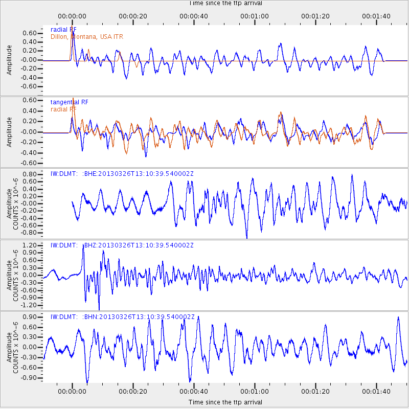
Signal To Noise
| Channel | StoN | STA | LTA |
| IW:DLMT: :BHZ:20130326T13:10:39.540002Z | 2.698446 | 4.488947E-7 | 1.6635305E-7 |
| IW:DLMT: :BHN:20130326T13:10:39.540002Z | 1.4203994 | 3.7976207E-7 | 2.6736285E-7 |
| IW:DLMT: :BHE:20130326T13:10:39.540002Z | 1.802326 | 3.4729027E-7 | 1.9269004E-7 |
| Arrivals |
| Ps | |
| PpPs | |
| PsPs/PpSs | |


