You are here: Home > Network List > TA - USArray Transportable Network (new EarthScope stations) Stations List
> Station F43A Flat Rock, Escanaba, MI, USA > Earthquake Result Viewer
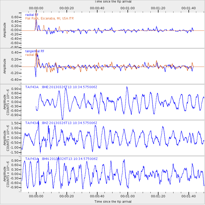
F43A Flat Rock, Escanaba, MI, USA - Earthquake Result Viewer
*The percent match for this event was below the threshold and hence no stack was calculated.
| Earthquake location: |
Near Coast Of Guerrero, Mexico |
| Earthquake latitude/longitude: |
16.2/-98.2 |
| Earthquake time(UTC): |
2013/03/26 (085) 13:04:48 GMT |
| Earthquake Depth: |
10 km |
| Earthquake Magnitude: |
5.5 MB, 5.0 MS, 5.5 MW, 5.4 MW |
| Earthquake Catalog/Contributor: |
WHDF/NEIC |
|
| Network: |
TA USArray Transportable Network (new EarthScope stations) |
| Station: |
F43A Flat Rock, Escanaba, MI, USA |
| Lat/Lon: |
45.83 N/87.17 W |
| Elevation: |
233 m |
|
| Distance: |
31.0 deg |
| Az: |
15.008 deg |
| Baz: |
200.847 deg |
| Ray Param: |
$rayparam |
*The percent match for this event was below the threshold and hence was not used in the summary stack. |
|
| Radial Match: |
51.767128 % |
| Radial Bump: |
400 |
| Transverse Match: |
69.490234 % |
| Transverse Bump: |
400 |
| SOD ConfigId: |
506627 |
| Insert Time: |
2013-06-07 04:06:03.803 +0000 |
| GWidth: |
2.5 |
| Max Bumps: |
400 |
| Tol: |
0.001 |
|
Signal To Noise
| Channel | StoN | STA | LTA |
| TA:F43A: :BHZ:20130326T13:10:34.575006Z | 1.2625477 | 7.9671906E-7 | 6.3104073E-7 |
| TA:F43A: :BHN:20130326T13:10:34.575006Z | 1.2765892 | 5.7357914E-7 | 4.4930596E-7 |
| TA:F43A: :BHE:20130326T13:10:34.575006Z | 0.59766614 | 2.6444926E-7 | 4.4246985E-7 |
| Arrivals |
| Ps | |
| PpPs | |
| PsPs/PpSs | |


