You are here: Home > Network List > TA - USArray Transportable Network (new EarthScope stations) Stations List
> Station G47A Hillman, MI, USA > Earthquake Result Viewer
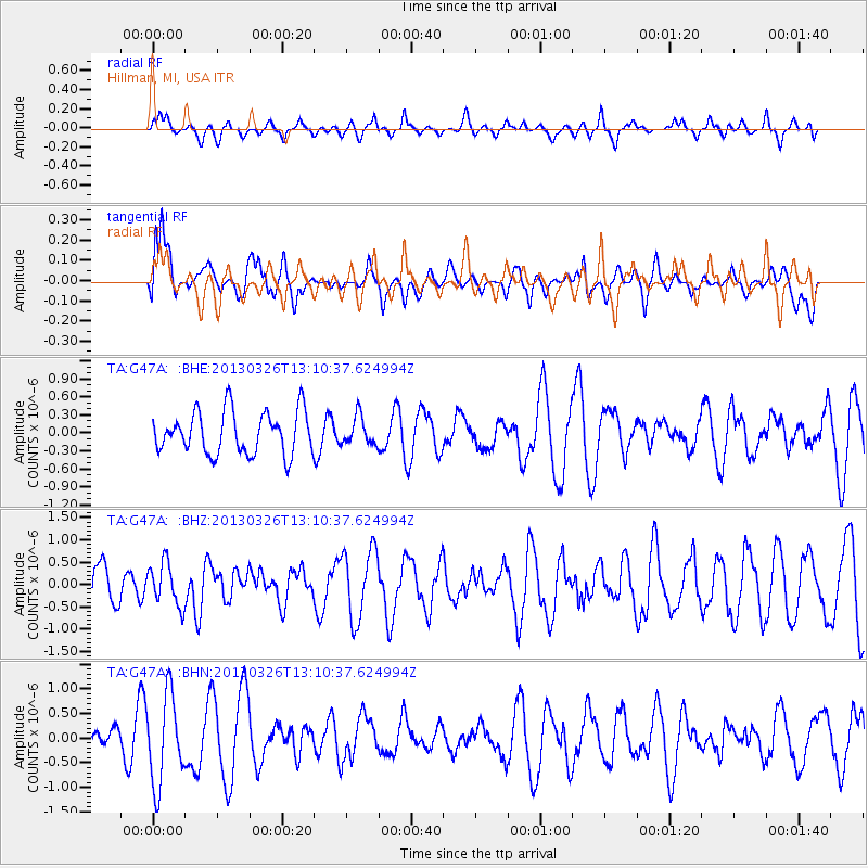
G47A Hillman, MI, USA - Earthquake Result Viewer
*The percent match for this event was below the threshold and hence no stack was calculated.
| Earthquake location: |
Near Coast Of Guerrero, Mexico |
| Earthquake latitude/longitude: |
16.2/-98.2 |
| Earthquake time(UTC): |
2013/03/26 (085) 13:04:48 GMT |
| Earthquake Depth: |
10 km |
| Earthquake Magnitude: |
5.5 MB, 5.0 MS, 5.5 MW, 5.4 MW |
| Earthquake Catalog/Contributor: |
WHDF/NEIC |
|
| Network: |
TA USArray Transportable Network (new EarthScope stations) |
| Station: |
G47A Hillman, MI, USA |
| Lat/Lon: |
45.17 N/83.86 W |
| Elevation: |
239 m |
|
| Distance: |
31.3 deg |
| Az: |
19.645 deg |
| Baz: |
207.173 deg |
| Ray Param: |
$rayparam |
*The percent match for this event was below the threshold and hence was not used in the summary stack. |
|
| Radial Match: |
60.559933 % |
| Radial Bump: |
400 |
| Transverse Match: |
66.85602 % |
| Transverse Bump: |
400 |
| SOD ConfigId: |
506627 |
| Insert Time: |
2013-06-07 04:06:42.923 +0000 |
| GWidth: |
2.5 |
| Max Bumps: |
400 |
| Tol: |
0.001 |
|
Signal To Noise
| Channel | StoN | STA | LTA |
| TA:G47A: :BHZ:20130326T13:10:37.624994Z | 1.141745 | 4.7771914E-7 | 4.1841145E-7 |
| TA:G47A: :BHN:20130326T13:10:37.624994Z | 2.5600986 | 8.973215E-7 | 3.505027E-7 |
| TA:G47A: :BHE:20130326T13:10:37.624994Z | 0.659135 | 2.3331694E-7 | 3.5397443E-7 |
| Arrivals |
| Ps | |
| PpPs | |
| PsPs/PpSs | |


