You are here: Home > Network List > CN - Canadian National Seismograph Network Stations List
> Station INK INUVIK, NT > Earthquake Result Viewer
INK INUVIK, NT - Earthquake Result Viewer
*The percent match for this event was below the threshold and hence no stack was calculated.
| Earthquake location: |
Taiwan |
| Earthquake latitude/longitude: |
23.8/121.2 |
| Earthquake time(UTC): |
2013/03/27 (086) 02:03:19 GMT |
| Earthquake Depth: |
19 km |
| Earthquake Magnitude: |
5.8 MB, 5.8 MS, 5.9 MW, 5.9 MW |
| Earthquake Catalog/Contributor: |
WHDF/NEIC |
|
| Network: |
CN Canadian National Seismograph Network |
| Station: |
INK INUVIK, NT |
| Lat/Lon: |
68.31 N/133.53 W |
| Elevation: |
44 m |
|
| Distance: |
73.5 deg |
| Az: |
21.963 deg |
| Baz: |
292.895 deg |
| Ray Param: |
$rayparam |
*The percent match for this event was below the threshold and hence was not used in the summary stack. |
|
| Radial Match: |
48.520313 % |
| Radial Bump: |
379 |
| Transverse Match: |
51.706184 % |
| Transverse Bump: |
400 |
| SOD ConfigId: |
506627 |
| Insert Time: |
2013-06-07 04:15:12.806 +0000 |
| GWidth: |
2.5 |
| Max Bumps: |
400 |
| Tol: |
0.001 |
|
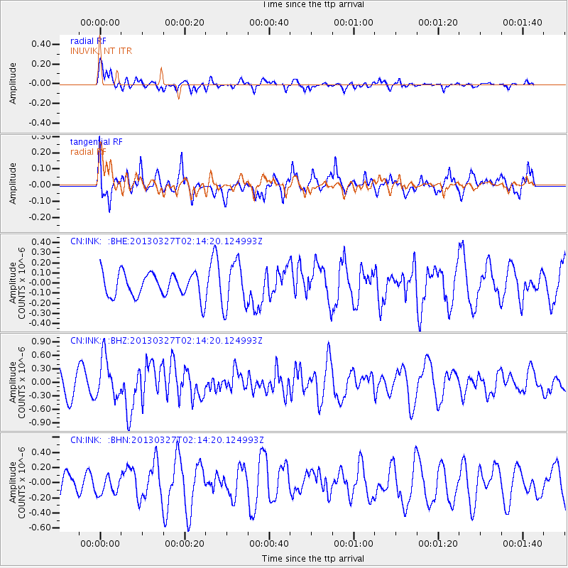
Signal To Noise
| Channel | StoN | STA | LTA |
| CN:INK: :BHZ:20130327T02:14:20.124993Z | 2.2701366 | 4.560908E-7 | 2.0090897E-7 |
| CN:INK: :BHN:20130327T02:14:20.124993Z | 0.35908368 | 1.1617887E-7 | 3.2354262E-7 |
| CN:INK: :BHE:20130327T02:14:20.124993Z | 1.9315995 | 2.26553E-7 | 1.1728777E-7 |
| Arrivals |
| Ps | |
| PpPs | |
| PsPs/PpSs | |


