You are here: Home > Network List > TA - USArray Transportable Network (new EarthScope stations) Stations List
> Station D46A Sault St. Marie, ON, CAN > Earthquake Result Viewer
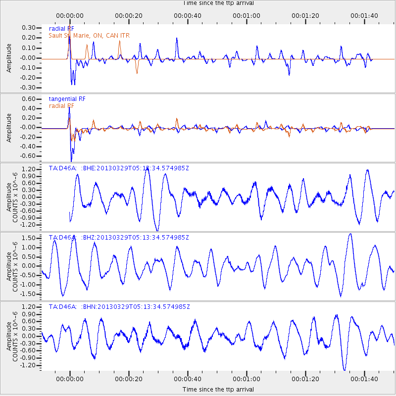
D46A Sault St. Marie, ON, CAN - Earthquake Result Viewer
*The percent match for this event was below the threshold and hence no stack was calculated.
| Earthquake location: |
Northern Xinjiang, China |
| Earthquake latitude/longitude: |
43.5/86.8 |
| Earthquake time(UTC): |
2013/03/29 (088) 05:01:09 GMT |
| Earthquake Depth: |
20 km |
| Earthquake Magnitude: |
5.5 MB, 5.1 MS, 5.2 MW, 5.5 MW |
| Earthquake Catalog/Contributor: |
WHDF/NEIC |
|
| Network: |
TA USArray Transportable Network (new EarthScope stations) |
| Station: |
D46A Sault St. Marie, ON, CAN |
| Lat/Lon: |
46.89 N/84.04 W |
| Elevation: |
353 m |
|
| Distance: |
89.7 deg |
| Az: |
353.762 deg |
| Baz: |
6.625 deg |
| Ray Param: |
$rayparam |
*The percent match for this event was below the threshold and hence was not used in the summary stack. |
|
| Radial Match: |
59.47446 % |
| Radial Bump: |
400 |
| Transverse Match: |
85.01037 % |
| Transverse Bump: |
400 |
| SOD ConfigId: |
506627 |
| Insert Time: |
2013-06-07 04:27:10.094 +0000 |
| GWidth: |
2.5 |
| Max Bumps: |
400 |
| Tol: |
0.001 |
|
Signal To Noise
| Channel | StoN | STA | LTA |
| TA:D46A: :BHZ:20130329T05:13:34.574985Z | 1.5530994 | 9.1097945E-7 | 5.8655576E-7 |
| TA:D46A: :BHN:20130329T05:13:34.574985Z | 1.2226765 | 3.521873E-7 | 2.8804615E-7 |
| TA:D46A: :BHE:20130329T05:13:34.574985Z | 1.929686 | 8.5568604E-7 | 4.4343278E-7 |
| Arrivals |
| Ps | |
| PpPs | |
| PsPs/PpSs | |


