You are here: Home > Network List > AZ - ANZA Regional Network Stations List
> Station SMER AZ.SMER > Earthquake Result Viewer
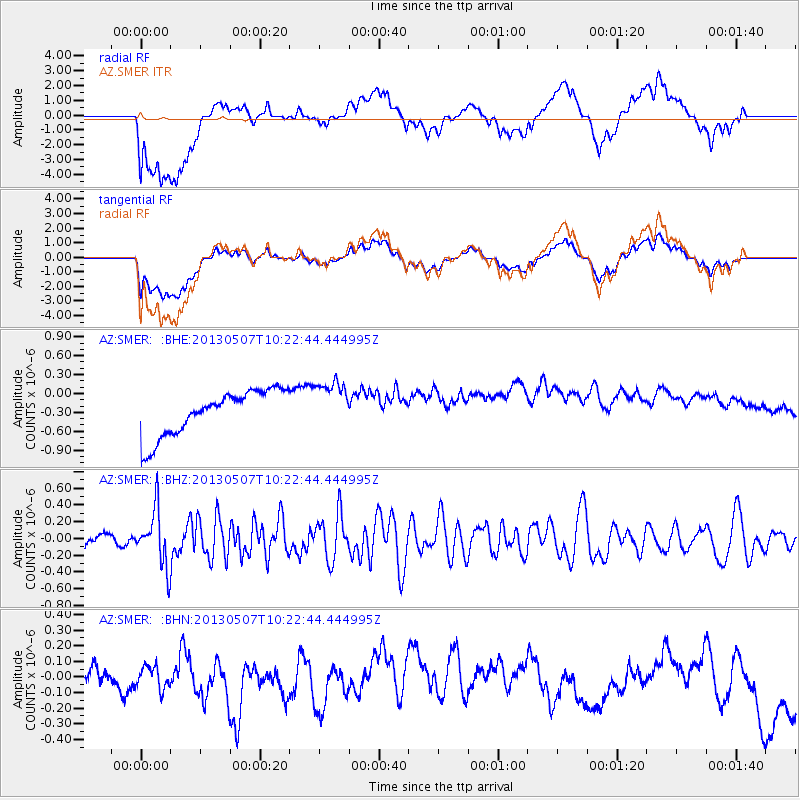
SMER AZ.SMER - Earthquake Result Viewer
*The percent match for this event was below the threshold and hence no stack was calculated.
| Earthquake location: |
South Of Fiji Islands |
| Earthquake latitude/longitude: |
-19.6/175.1 |
| Earthquake time(UTC): |
2013/05/07 (127) 10:10:48 GMT |
| Earthquake Depth: |
11 km |
| Earthquake Magnitude: |
5.6 MB, 5.7 MS, 6.0 MW, 5.9 MW |
| Earthquake Catalog/Contributor: |
WHDF/NEIC |
|
| Network: |
AZ ANZA Regional Network |
| Station: |
SMER AZ.SMER |
| Lat/Lon: |
33.46 N/117.17 W |
| Elevation: |
355 m |
|
| Distance: |
83.4 deg |
| Az: |
51.174 deg |
| Baz: |
241.455 deg |
| Ray Param: |
$rayparam |
*The percent match for this event was below the threshold and hence was not used in the summary stack. |
|
| Radial Match: |
36.120934 % |
| Radial Bump: |
400 |
| Transverse Match: |
36.55515 % |
| Transverse Bump: |
400 |
| SOD ConfigId: |
508211 |
| Insert Time: |
2013-07-12 08:15:45.468 +0000 |
| GWidth: |
2.5 |
| Max Bumps: |
400 |
| Tol: |
0.001 |
|
Signal To Noise
| Channel | StoN | STA | LTA |
| AZ:SMER: :BHZ:20130507T10:22:44.444995Z | 4.562816 | 3.3223264E-7 | 7.2813066E-8 |
| AZ:SMER: :BHN:20130507T10:22:44.444995Z | 0.8884062 | 7.434754E-8 | 8.368643E-8 |
| AZ:SMER: :BHE:20130507T10:22:44.444995Z | 1.1077241 | 3.9650513E-7 | 3.5794577E-7 |
| Arrivals |
| Ps | |
| PpPs | |
| PsPs/PpSs | |


