You are here: Home > Network List > CI - Caltech Regional Seismic Network Stations List
> Station MPP McPhearson Peak > Earthquake Result Viewer
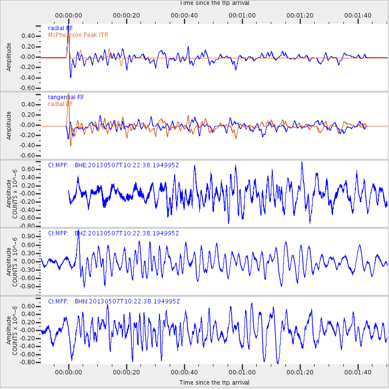
MPP McPhearson Peak - Earthquake Result Viewer
*The percent match for this event was below the threshold and hence no stack was calculated.
| Earthquake location: |
South Of Fiji Islands |
| Earthquake latitude/longitude: |
-19.6/175.1 |
| Earthquake time(UTC): |
2013/05/07 (127) 10:10:48 GMT |
| Earthquake Depth: |
11 km |
| Earthquake Magnitude: |
5.6 MB, 5.7 MS, 6.0 MW, 5.9 MW |
| Earthquake Catalog/Contributor: |
WHDF/NEIC |
|
| Network: |
CI Caltech Regional Seismic Network |
| Station: |
MPP McPhearson Peak |
| Lat/Lon: |
34.89 N/119.81 W |
| Elevation: |
1739 m |
|
| Distance: |
82.2 deg |
| Az: |
48.836 deg |
| Baz: |
239.684 deg |
| Ray Param: |
$rayparam |
*The percent match for this event was below the threshold and hence was not used in the summary stack. |
|
| Radial Match: |
63.18233 % |
| Radial Bump: |
400 |
| Transverse Match: |
53.16094 % |
| Transverse Bump: |
400 |
| SOD ConfigId: |
508211 |
| Insert Time: |
2013-07-12 08:18:59.639 +0000 |
| GWidth: |
2.5 |
| Max Bumps: |
400 |
| Tol: |
0.001 |
|
Signal To Noise
| Channel | StoN | STA | LTA |
| CI:MPP: :BHZ:20130507T10:22:38.194995Z | 2.9771101 | 4.008543E-7 | 1.3464545E-7 |
| CI:MPP: :BHN:20130507T10:22:38.194995Z | 2.396731 | 3.3619546E-7 | 1.402725E-7 |
| CI:MPP: :BHE:20130507T10:22:38.194995Z | 1.6102295 | 2.2485592E-7 | 1.3964217E-7 |
| Arrivals |
| Ps | |
| PpPs | |
| PsPs/PpSs | |


